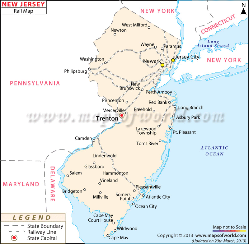
The New Jersey Railway Map clearly defines the routes, which pass through the different cities of the state.
Passenger liners and freight cars serve the towns of Jersey City, Philadelphia, Trenton, Newark, Chester, and Peterson among several others. Norfolk Southern and CSX own Consolidated Rail, which provides a number of freight carriers to New Jersey. In addition, Amtrak, a reputed railroad company, offers regular railway service to various parts of the state. There are around 90 trains that traverse many cities including Trenton and Newark. New Jersey Transit Corporation is an active organization under which 711 trains operate on 11 railway tracks.
Class I track connects about 70% of the railway. In the year of 2000, a total of 23,352.5 miles of railway track covered the state of New Jersey.
Apart from highlighting the train routes, the railway map also shows the states that border New Jersey such as Pennsylvania, Delaware, and New York.
The New Jersey State map also shows the location of the railway routes.
 Wall Maps