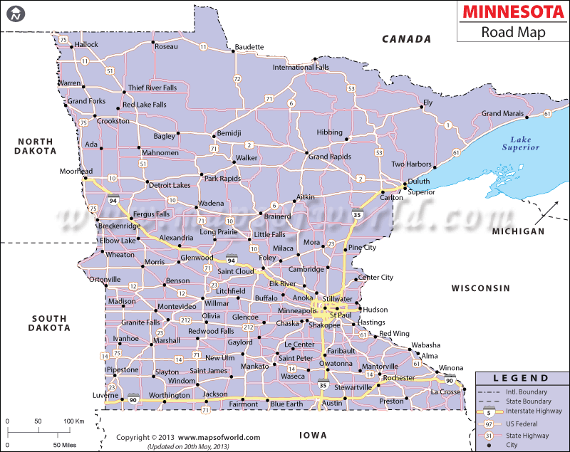
The Minnesota Road Map indicates state and national highways, county roads, and streets within Minnesota. The northern part of Minnesota is connected with the southern part of the state by the I-35. I-90 and I-94 make traveling from the eastern and western halves of the state equally easy.
As of 2000, Minnesota had 132,250 miles of roads, including 116,232 miles of rural roads and 16,018 miles of urban roadways. The state hosted 2,625,595 automobiles, 1,989,580 trucks, and 14,765 public and private buses. All of the important cities in Minnesota are connected by the roadway system. I-35 connects Minneapolis with Duluth, and I-94 conveniently joins Fargo and Moorhead. The county roads also connect the 87 counties of the state. Some of the notable county roads of Minnesota include CSAH 18, CSAH 42, and Ayd Mill Road. CSAH 18 provides accessibility to Scott County and CSAH 42 connects the counties of Scott and Dakota.
The Minnesota Map highlights the counties and cities that are connected by the roads of the state.
 Wall Maps