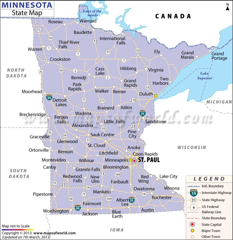
The topography, politically significant areas, roads, railway routes, and cities are all highlighted on the Minnesota Map.
St. Paul is the capital city of Minnesota and is clearly marked. Towns like Fairmont, Benson, Roseau, Pine City, Glenwood, Ely, Anoka, Graceville, Sauk Center, Austin, Owatonna and several others are indicated, as well. The state of Minnesota is located on the western front of north-central United States. Wisconsin, South Dakota, Canada, North Dakota and Iowa, all nearby, are also shown on the map.
The 132,250 miles of roadways are displayed on the map, as are the railway routes.
 Wall Maps