1.3K
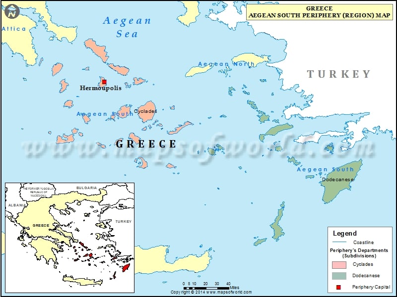
Municipalities of Aegean South |
||||
| Municipality | Region | Area(km.²) | Pop-2001 | |
|---|---|---|---|---|
| Agathonissi | Aegean South | 15 | 152 | |
| Amorgos | Aegean South | 126 | 1852 | |
| Anafi | Aegean South | 40 | 272 | |
| Andros | Aegean South | 380 | 9285 | |
| Antiparos | Aegean South | 45 | 1011 | |
| Astypalea | Aegean South | 114 | 1385 | |
| Chalki | Aegean South | 37 | 295 | |
| Folegandros | Aegean South | 32 | 676 | |
| Ios | Aegean South | 109 | 1862 | |
| Kalymnos | Aegean South | 135 | 16576 | |
| Karpathos | Aegean South | 325 | 6565 | |
| Kassos | Aegean South | 69 | 1013 | |
| Kea | Aegean South | 149 | 2162 | |
| Kimolos | Aegean South | 53 | 838 | |
| Kos | Aegean South | 290 | 30828 | |
| Kythnos | Aegean South | 100 | 1538 | |
| Leros | Aegean South | 74 | 8172 | |
| Lipsi | Aegean South | 17 | 687 | |
| Megisti | Aegean South | 12 | 403 | |
| Milos | Aegean South | 160 | 4736 | |
| Mykonos | Aegean South | 105 | 9274 | |
| Naxos and Mikres Kyklades | Aegean South | 496 | 18229 | |
| Nissyros | Aegean South | 50 | 928 | |
| Paros | Aegean South | 196 | 12514 | |
| Patmos | Aegean South | 45 | 3053 | |
| Rhodes | Aegean South | 1401 | 115334 | |
| Serifos | Aegean South | 75 | 1262 | |
| Sifnos | Aegean South | 74 | 2574 | |
| Sikinos | Aegean South | 43 | 238 | |
| Symi | Aegean South | 66 | 2594 | |
| Syros-Ermoupoli | Aegean South | 102 | 19793 | |
| Thira | Aegean South | 91 | 13725 | |
| Tilos | Aegean South | 65 | 521 | |
| Tinos | Aegean South | 194 | 8115 | |
previous post
