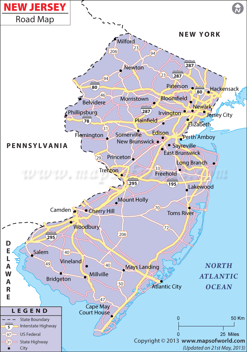
The New Jersey Road Map highlights several roads, including national (Interstate or I) and state (US) highways that run through New Jersey connecting its different parts.
The major highways joining the north and south are I-287, I-95, and I-295. I-78 and I-80 have made the eastern end of New Jersey easily accessible to the western part of the state. Some of the prominent state highways are US-206, US-30, US-322, US-9, US-1, US-22, and US-46. Constructed in 1952, the New Jersey Turnpike connects the counties of Bergen and Salem. The Garden State Parkway is another notable road that stretches 172.74 miles.
New Jersey had a total of 36,021 miles of road in 2000, which included 11,837 miles of county road and 24,184 miles of municipal road.
The New Jersey Department of Transportation uses new technologies to improve the traffic conditions in the state. It has installed several cameras on the state highways for safe communication.
 Wall Maps