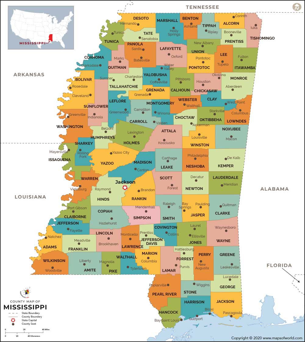
Mississippi is the 20th state of the United States and is situated in the southern parts of the country.
The biggest city and capital of Mississippi is Jackson. The name of the state was originated from the famous Mississippi River.
About Mississippi Counties
The U.S. state of Mississippi is a quite big state and is made up of 82 counties. The state equals Arkansas for majority of counties with two county seats, at 10. The postal code of the state is MS and the FIPS state code is 28. A Mississippi county seat map shows the different counties in the state with their corresponding county seats. Some of the important counties with their county seats are given below:
 Wall Maps