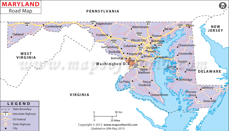
The Maryland Road Map marks interstate 495, interstate 97, interstate 68, interstate 81, interstate 70, interstate 695, interstate 270 and interstate 83.
All the interstate highways connect the cities and towns spread across the state.
While the east-west routes of Maryland are connected to interstate 270, 70, and 68, the north-south ends of the state are connected via interstate 695, 81, 495, 97 and 83.
Larger cities like Annapolis, Waldorf, Pocomoke, Hagerstown, Cumberland, Westminster, Solomons, Salisbury, Frederic, Ocean City and others are connected to the state roads, as shown.
The John F. Kennedy Memorial Highway is the primary toll road in Maryland and connects Baltimore with the New Jersey Turnpike, Delaware and Wilmington.Equipped with a total of 30,427 miles of road (according to a 2000 survey), Maryland possesses 3,847,538 registered motor vehicles.
 Wall Maps