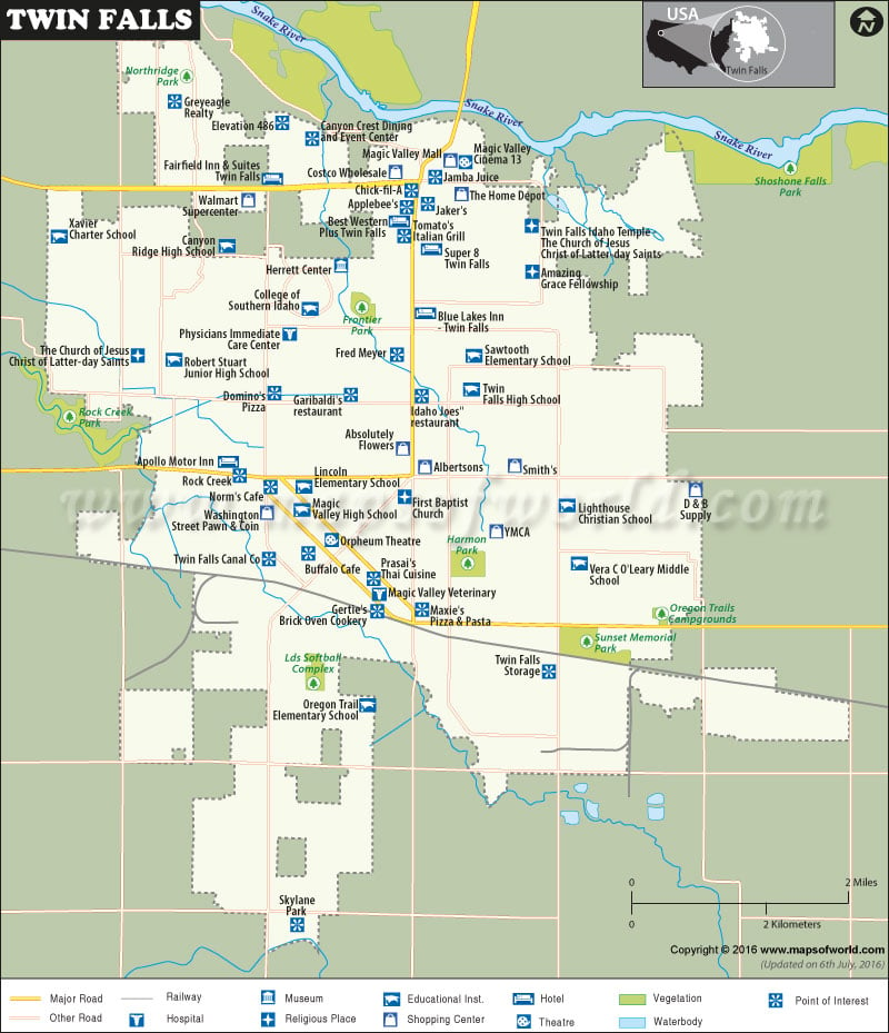
Twin Falls City Facts |
|---|
| Country | USA (United States of America) |
|---|---|
| State | Idaho |
| County | Twin Falls County |
| Total Area | 12 sq miles |
| Lat Long Coordinates | 42.5631° N, 114.4600° W |
| Time Zone | MST (UTC−07:00) |
| Area Code | 208 |
| Language | English |
| Major Religion | Roman Catholic, Christian |
| Official Website | www.tfid.org/ |
Airports:
| oslin Field Magic Valley Regional Airport |
Twin Falls is a city in the U.S state of Idaho. Founded in 1904 as a planned community, the city was named after a nearby waterfall on the Snake River. The city became the seat of the newly formed Twin Falls County in 1907. It developed into a major regional economic center and later by 1960, it became one of the largest city in the state. Twin Falls is now the county seat and largest city of Twin Falls County. It is also regarded as the largest city of Idaho’s Magic Valley region and the seventh largest in the state.
Hotels:
The hotels in Twin Falls offer all modern amenities to its guests. The mouth-watering dishes served in addition to this wins the heart of the tourists. Shilo Inn Suites, Holiday Inn Express, AmeriTel Inn, Hampton Inn, Super 8, Comfort Inn, Red Lion Hotel Canyon Springs, Best Western Weston Inn, Best Western Apollo Motor Inn and Motel 6 are the famous hotels in the city.
Restaurants:
some of the well known restaurants are:
- Gerties Brick Oven Cookery
- Tomatos Italian Grill
- Chili’s Grill and Bar
- Johnny Carino’s
- Outback Steakhouse
- Montana Steak House
- Creekside Steak House
Climate:
The climate of Twin Falls is primarily influenced by the Pacific Ocean.It mainly receives its precipitation from the moisture-laden wind that blows in from the ocean during the summer. But as such twin Falls, located on top of an arid plateau, receives very infrequent and scanty rainfall. The summers in Twin Falls are usually hot and dry while the winters are cold. There is also occasional snowfall in winter.
Places of Attraction:
A walk along the 486 feet long Perrine Bridge over the Snake River Gorge gives a spectacular view of the canyon. ‘Niagara of the West’, Shoshone Falls and Sawtooth National Forest reveal the natural beauty of the city.
 Wall Maps