5K
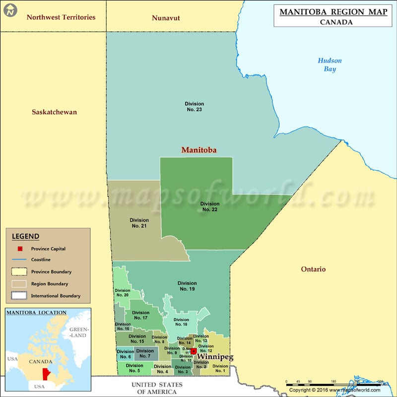
List of census divisions of Manitoba
- Division no.1 Eastern Manitoba, Eastman Region
- Division no.2 Steinbach Area, Eastman Region
- Division no.3 Pembina Valley, Pembina Valley Region
- Division no.4 Pilot Mound Area, Pembina Valley Region
- Division no.5 South West Westman
- Division no.6 Virden Area, Westman
- Division no.7 Brandon Area, Westman
- Division no.8 Central Manitoba, Central Plains Region
- Division no.9 Portage la Prairie Area, Central Plains Region
- Division no.10 Whitehorse Plains, Central Plains Region
- Division no.11 Winnipeg, Winnipeg Capital Region
- Division no.12 Beausejour Area, Eastman Region
- Division no.13 Selkirk Area, Interlake Region
- Division no.14 South Interlake Interlake Region
- Division no.15 Western Manitoba Westman
- Division no.16 Roblin, Russell, Rossburn Area, Parkland Region
- Division no.17 Dauphin, Parkland Region
- Division no.18 North Interlake Area Interlake Region
- Division no.19 North East Northern Region
- Division no.20 Swan River, Parkland Region
- Division no.21 Flin Flon and North West Northern Region
- Division no.22 Thompson and North Central Northern Region
- Division no.23 Churchill and Northern Manitoba, Northern Region
