6.4K
- Maryland Counties - Maryland County Map, Map of Maryland Counties
- Major Cities of Maryland - Frederick, Annapolis, Baltimore
- Neighbouring States - Pennsylvania, Delaware, Virginia, West Virginia
- Regional Maps - Map of USA
- Other Maryland Maps - Maryland Map, Maryland Physical Map, Maryland Airports Map, Maryland Lat Long Map, Maryland Zip Code Map, Maryland Area Code Map, Maryland Narional Parks Map
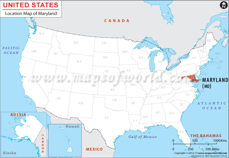
Maryland shares its northern border with Pennsylvania, its eastern border with the Atlantic Ocean and Delaware, its southern and southwestern border with Virginia, West Virginia and the District of Columbia and some parts of its western border with West Virginia.
The state has a total area of 16,797.42 square miles, out of which 15,796.36 square miles is the total land area and 1,000 square miles is the total inland water area.
| City Name | Maryland |
|---|---|
| Country | USA |
| Continent | North America |
| Capital | Annapolis |
| Largest city | Baltimore |
| Area | 12,407 sq mi (32,133 km2) |
| Population | 5,976,407 (2014 est) |
| Lat Long | 39° 0′ 0″ N, 76° 42′ 0″ W (39, -76.7) |
| Official Language | None (English, de facto) |
| Calling Code | |
| Time Zone | Eastern: UTC −5/−4 |
| Airport | 22 Airports |
| Neighbour countries | Delaware, Pennsylvania, Virginia, West Virginia |
| Internet TLD | .md |
| Currency | £sd and Spanish dollars |
 Wall Maps