3.2K
- Neighboring Countries - Belize, El Salvador, Honduras, Mexico
- Continent And Regions - North America Map, Americas Map
- Other Guatemala Maps - Guatemala Map, Where is Guatemala, Guatemala Blank Map, Guatemala Road Map, Guatemala Rail Map, Guatemala River Map, Guatemala Cities Map, Guatemala Physical Map, Guatemala Flag
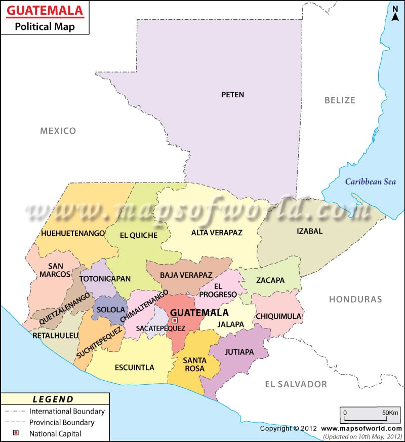
Guatemala is located in North America with Caribbean Sea on its eastern side and North Pacific Ocean on its western side. Guatemala shares its borders with:
| Population | Area(km.²) | Area(mi.²) | Capital | |
|---|---|---|---|---|
| Alta Verapaz | 776,246 | 8,686 | 3,354 | Coban |
| Baja Verapaz | 215,915 | 3,124 | 1,206 | Salama |
| Chimaltenango | 446,133 | 1,979 | 764 | Chimaltenango |
| Chiquimula | 302,485 | 2,376 | 917 | Chiquimula |
| El Progreso | 139,490 | 1,922 | 742 | Guastatoya |
| Escuintla | 538,746 | 4,384 | 1,693 | Escuintla |
| Guatemala | 2,541,581 | 2,126 | 821 | Guatemala City |
| Huehuetenango | 846,544 | 7,400 | 2,857 | Huehuetenango |
| Izabal | 314,306 | 9,038 | 3,490 | Puerto Barrios |
| Jalapa | 242,926 | 2,063 | 797 | Jalapa |
| Jutiapa | 389,085 | 3,219 | 1,243 | Jutiapa |
| Peten | 366,735 | 35,854 | 13,843 | Flores |
| Quetzaltenango | 624,716 | 1,951 | 753 | Quetzaltenango |
| Quiche | 655,510 | 8,378 | 3,235 | Santa Cruz del Quiche |
| Retalhuleu | 241,411 | 1,856 | 717 | Retalhuleu |
| Sacatepequez | 248,019 | 465 | 180 | Antigua Guatemala |
| San Marcos | 794,951 | 3,791 | 1,464 | San Marcos |
| Santa Rosa | 301,370 | 2,955 | 1,141 | Cuilapa |
| Solola | 307,661 | 1,061 | 410 | Solola |
| Suchitepequez | 403,945 | 2,510 | 969 | Mazatenango |
| Totonicapan | 339,254 | 1,061 | 410 | Totonicapan |
| Zacapa | 200,167 | 2,690 | 1,039 | Zacapa |
| 22 departments | 11,237,196 | 108,889 | 42,045 |
 Wall Maps
 Guatemala Airport