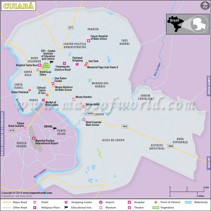
Cuiaba is the capital city of the state of Mato Grosso in Western Brazil. It is located between -15.60 latitude and -56.10 longitude with an elevation of 193 meters above sea level. The biggest city in Mato Grosso is located exactly at the centre of South America. Cuiaba serves as the main gateway to the northern part of the Pantanal – the world’s largest tropical wetland area. The city had hosted games of the 2014 FIFA World Cup.
The map shows Marechal Rondon International Airport as the closest airport to Cuiaba located in the neighboring city of Várzea Grande, which is also the second largest city in Mato Grosso state. This Cuiaba travel map shows the major attractions such as Sesi Park and Arena Pantanal. Hotels, shopping centers, and Cine Teatro Cuiaba are also marked on this colorful map. Road networks, forested areas, and waterbodies are clearly depicted.
Attractions in Cuiaba
- Basilica do Senhor Bom Jesus de Cuiabá
- Museu do Rio Cuiabá
- Praça de República
- Palácio de Instrução
- Parque Antonio Pires de Campos
Things to do in Cuiaba
- Go on a wildlife-spotting drive along the Transpantaneira Highway.
- Explore the Pantanal – tropical wetland area – on the back of a horse.
- Try canoeing in one of the small rivers of North Pantanal. That’s the best way to spot monkeys and river otters.
- Admire the red-rock formations and canyons during a trip to the Chapada dos Guimarães in the north of Cuiabá. Watch biurds and witness massive waterfalls.
How to Reach Cuiaba?
By Air: Marechal Rondon International Airport, located 6 miles (10 km) from downtown Cuiabá, connects it with other Brazilian cities such as Porto Alegre, Rio de Janeiro, Belo Horizonte, Brasilia, Campinas, and Campo Grande.
By Road: Nearby cities such as Campo Grande (557 km), Goiania (746 km), and Brasilia (878 km) can be directly connected via insterstate buses.
