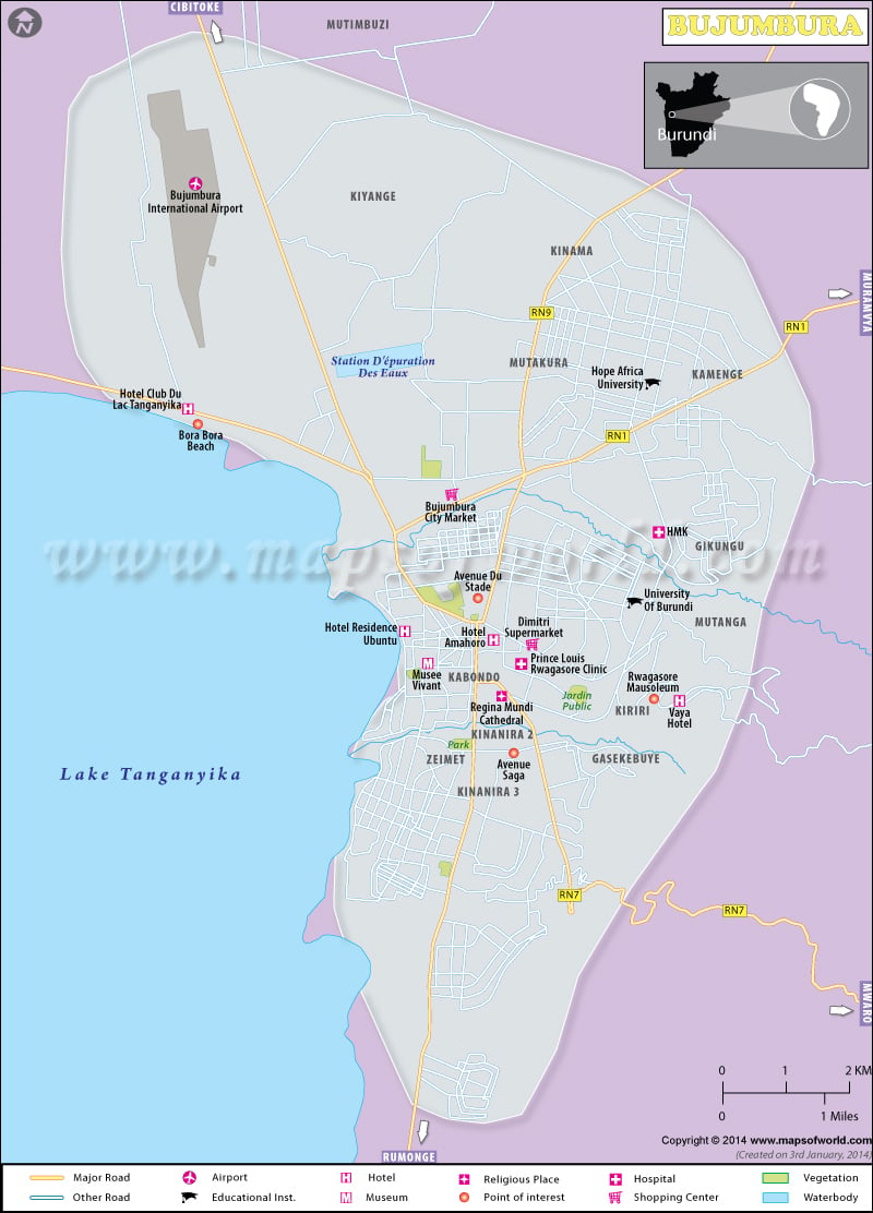
Bujumbura is the largest city and main administrative division of Burundi. Situated in the northeast part of Lake Tanganyika in Burundi, it is the capital city of the country.
Bujumbura serves as the economic as well as the communication hub of the country. Formerly, the city was known as “Usumbura”. Burundi became independent in 1962 and was renamed ” Bujumbura”. After the end of the civil war in 2005, the city now lives in peace. It houses some of the major attractions of the country, namely,
- Burundi Museum of Life
- Burundi Geological Museum
- Islamic Cultural Center
- Rusizi National Park (nearby tourist attraction)
Bujumbura Flights
It is very easy for tourists to reach Bujumbura, a city in Burundi. There are several airlines serving the Bujumbura International Airport. The Bujumbura flights include:
- Kenya Airways
- Rwandair Express
- Brussels Airlines
- Ethiopian Airlines
- China Postal Airlines
Air Burundi, the national airline of the country ceased operations in 2007. This airline also used to maintain flight operations from the Bujumbura International Airport to various parts of Burundi.
Hotels Bujumbura
Bujumbura offers a wide array of accommodation facilities from good to excellent standards. The city has several hotels providing a wide range of services to tourists. The most popular hotels in Bujumbura are:
- Club des Vacances Hotel
- Novotel Bujumbura
- 2Source Du Nil Hotel
- Hotel Chez Vaya
- Hotel Club du Lac Tanganyika

 Bururi Map