3.2K
- Neighboring Countries - South Africa
- Continent And Regions - Africa Map
- Other Lesotho Maps - Lesotho Map, Lesotho Blank Map, Lesotho Road Map, Lesotho River Map, Lesotho Cities Map, Lesotho Political Map, Lesotho Physical Map, Lesotho Flag
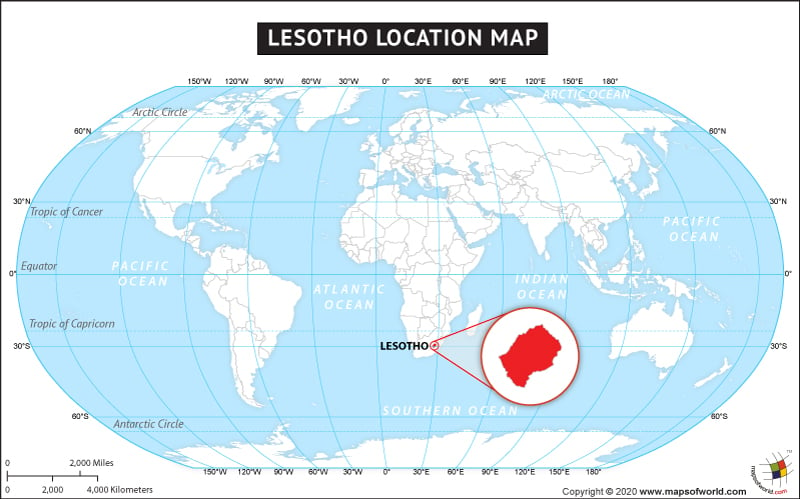
The country of Lesotho is on the African continent and the latitude and longitude of Lesotho are 29.5495° S, and 28.1851° E.
The neighboring country of Lesotho is :
Facts About Lesotho |
| Country Name | Lesotho |
|---|---|
| Continent of Lesotho | Africa |
| Capital and largest city of Lesotho | Maseru |
| Area | 30,355 km2 (11,720 sq mi) |
| Population | 2,067,000 (2009 estimate) |
| Lat Long map of Lesotho | 29.4667° S, 27.9333° E |
| Official Language | Sotho, English |
| Calling Code | +266 |
| Time Zone | SAST (UTC+2) |
| Airports of Lesotho | 24 Airports |
| Neighbour Countries | South Africa |
| Internet TLD | .ls |
| Currency | Lesotho loti (LSL) |

 Lesotho Population