- Vietnam Cities - Hanoi, Ho Chi Minh
- Neighboring Countries - Cambodia, China
- Continent And Regions - Asia Map
- Other Vietnam Maps - Vietnam Map, Where is Vietnam, Vietnam Blank Map, Vietnam Rail Map, Vietnam River Map, Vietnam Political Map, Vietnam Physical Map, Vietnam Flag
Vietnam also known as the Socialist Republic of Vietnam is Southeast Asia’s easternmost country. This oblong S-shaped country is the world’s thirteenth most populated country. The transport system of Vietnam was developed under French rule. Roads are the most popular transportation systems used in this country.
Vietnam Roads include national roads, Provincial roads, District roads, urban roads, and commune roads. 222,179 km is the total length of the road network within Vietnam out of which 17,295 km is the total length of the national roads.
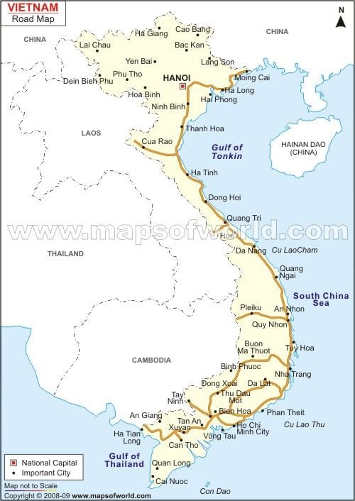
Vietnam Road Map indicates the Asian Highway 1; commonly known as AH1 and the major roads connecting the various cities of Vietnam. AH1 indicated of the Vietnam road map is the longest road network connecting various Asian countries like Japan, India, China, Vietnam, etc.
Location in the Map
Major Location:
Gao Bang, Lai Chau, Yen Bai, Dinh Binh, Phu, China, Mong Cai, Hai Pong, Thanh Hao, Cua Rao, Gulf of Tonkin, Ba Don, Dong Hai, Laos, Quang Tri, Hue, Da-Nang, Thailand, Quajg Ngai, Plaiku, An Nhon, Qui Nhon, Nha Trang, Da Lat, Loc Ninh, Bien Hoa, Ptram Thiet, Ho Chi, MInh City, tan An, Ha tiet Long, Xuyan Can Tho, Quan LOng.
NEIGHBOUR COUNTRIES/ISLANDS:
OCEANS, SEAS, RIVERS, BAYS, AND CANALS
Gulf of Tonkin, South China Sea, Gulf of Thailand.

 Demography of Vietnam