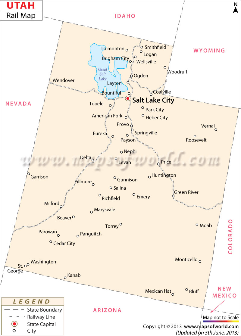
The Utah Railway Map provides detailed information on the several rail routes of the state. The well laid railway tracks of the state provide comfortable intra and inter-state accessibility.
The State of Utah had 3,629 kilometer of total railway lines in the year of 2000. The rail road service provider of Amtrak offers excellent railway services to Ogden, Helper, Salt Lake City, Thompson, Milford and Provo. Alta Scenic Railway, Belt Line Railroad, Cache Valley Railroad, California Short Line Railway, Tintic Range Railway, Utah and Idaho Railroad, Deep Creek Railroad, Eureka Hill Railway, Emigration Canyon Railroad, National Coal Railway, Kenilworth and Helper Railway, Malad Valley Railroad and Ogden and Northwestern Railroad are some of the well known rail road service providers of Utah. Originally known as the Utah Coal Railway Company, the Utah Railway Company was founded on the 24th of January in 1912. Apart from passenger trains, the Utah Railway Company operates several freight trains as well. The Utah State Map prominently marks the major cities that are easily accessible by the railway lines of the state. The railway lines connect the important towns of Price, Springville, Provo, Eureka, Grantsville, Wendover and Brigham City. Railway is one of the most convenient and easiest means of communication in Utah.
Utah Rail Map
The Railway Network in Utah connects the many major and other towns in Utah.
6.4K
previous post
 Wall Maps
