5.4K
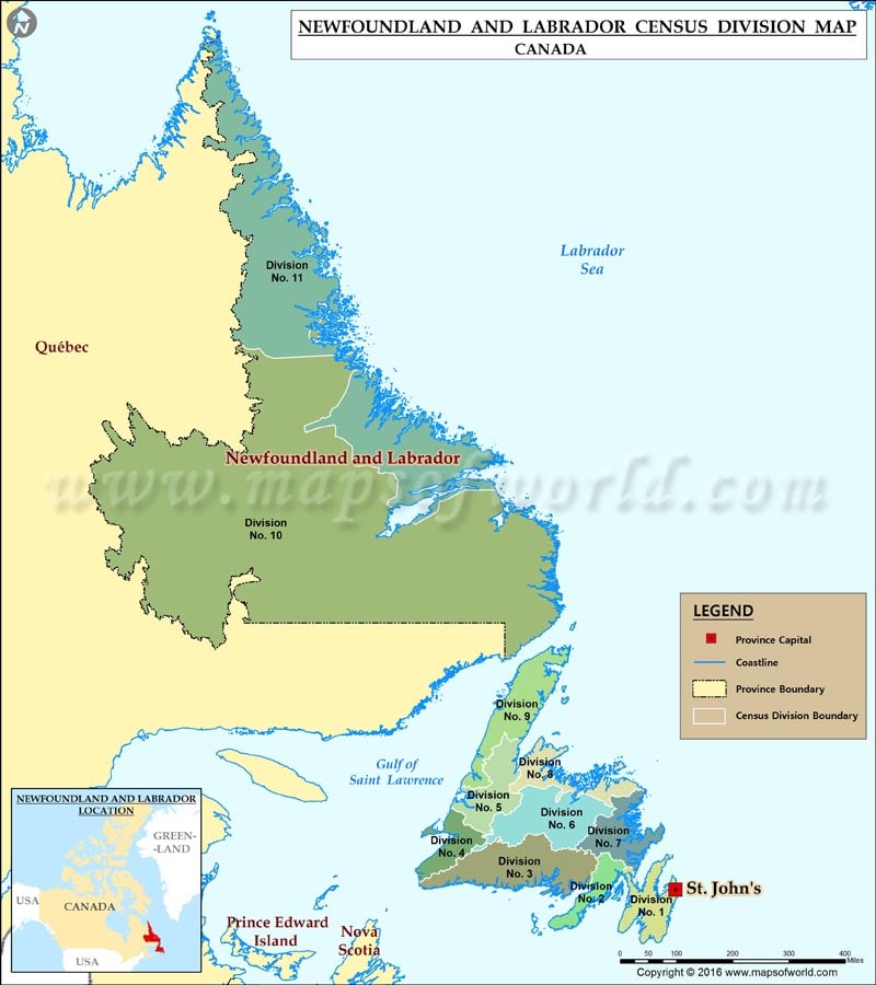
List of census divisions of Newfoundland and Labrador
- Division No. 1, Newfoundland and Labrador (Avalon Peninsula-St. John’s)
- Division No. 2, Newfoundland and Labrador (Burin Peninsula-Marystown)
- Division No. 3, Newfoundland and Labrador (South Coast-Channel-Port aux Basques)
- Division No. 4, Newfoundland and Labrador (St. George’s-Stephenville)
- Division No. 5, Newfoundland and Labrador (Humber District-Corner Brook)
- Division No. 6, Newfoundland and Labrador (Central Newfoundland-Grand Falls-Windsor)
- Division No. 7, Newfoundland and Labrador (Bonavista/Trinity-Clarenville)
- Division No. 8, Newfoundland and Labrador (Notre Dame Bay-Lewisporte)
- Division No. 9, Newfoundland and Labrador (Northern Peninsula-St. Anthony)
- Division No. 10, Newfoundland and Labrador (Labrador-Happy Valley-Goose Bay)
- Division No. 11, Newfoundland and Labrador (Nunatsiavut-Nain)
