- Neighboring Countries - Bhutan, Nepal, Myanmar, India
- Continent And Regions - Asia Map
- Other Bangladesh Maps - Bangladesh Map, Where is Bangladesh, Bangladesh Blank Map, Bangladesh Road Map, Bangladesh Rail Map, Bangladesh River Map, Bangladesh Cities Map, Bangladesh Physical Map, Bangladesh Flag
The People’s Republic of Bangladesh is a country located in South Asia, as shown in the map of Bangladesh. It covers an area of 56,977 square miles. As of 2017, the estimated population of the Republic was 164.67 million (World Bank, 2017).
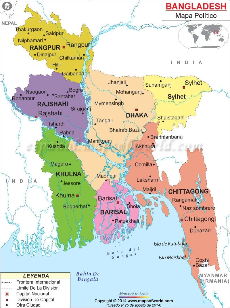
As shown in the political map of Bangladesh, the country is a sovereign state and shares its borders with India from all the sides except for Burma in the south-east and Bay of Bengal in the south as shown in the Bangladesh Map.
The political map of Bangladesh also highlights the national capital, major cities, districts, and other political divisions of the country. Dhaka, the national capital is clearly represented in the Bangladesh Map. It is located on the banks of Buriganga River and is popularly known as the “City of Mosques”.
The other major cities of Bangladesh are: Chittagong, Khulna, Rajshahi, Sylhet, Barisal, Bogra, Comilla, Mymensingh and Rangpur which are marked on the map of Bangladesh. These cities function as administrative divisions of the state and are further divided into districts as shown in the Bangladesh Map.
A unitary state, Bangladesh is a parliamentary democracy. The head of the state is the president of the country, while the prime minister is the head of the government. Abdul Hamid is the current President (Acting) of Bangladesh and Sheikh Hasina is the current Prime Minister.
| Division | Population | Area(km.²) | Area(mi.²) |
|---|---|---|---|
| Barisal | 8,325,666 | 13,225 | 5,106 |
| Chittagong | 28,423,019 | 33,909 | 13,092 |
| Dhaka | 36,433,505 | 20,509 | 7,919 |
| Khulna | 15,687,759 | 22,284 | 8,604 |
| Mymensingh | 10,990,913 | 10,669 | 4,119 |
| Rajshahi | 18,484,858 | 18,153 | 7,009 |
| Rangpur | 15,787,758 | 16,185 | 6,249 |
| Sylhet | 9,910,219 | 12,635 | 4,878 |
| 8 divisions | 149,772,364 | 147,569 | 56,977 |
