logo


Bhutan Latitude and Longitude Map

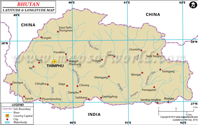
Bhutan's latitude and longitude is 27° 30' N and 90° 30' E . Below is the map of Bhutan showing major towns, roads, airports with latitudes and longitudes plotted on it.
Bhutan Latitude and Longitude Map China Lat Long India Lat Long
Description : Find Bhutan latitude and longitude map showing comprehensive details including cities, roads, towns, airports and much more. Disclaimer
×

Disclaimer  :  All efforts have been made to make this image accurate. However MapSherpa, Inc, its directors and employees do not own any responsibility for the correctness or authenticity of the same.


Search For Latitude & Longitude Map

By Country

Or

Latitude

Longitude

Or

Area

* Put South & West values with minus ( - ) sign.


The latitude and longitude of Bhutan which is used to signify its geographical location is 27° 30'North and 90° 30'East.

The country of Bhutan is a small Asian country which falls between China and India. The climate of Bhutan is mostly cool and pleasant as it is located on the foothills of the Himalayas. Though latitude and longitude of Bhutan falls within the Northern hemisphere and between the equator and Tropic of Cancer, it does not have a typical tropical climate.

The latitude and longitude of the capital of Bhutan , Thimpu, is 27° 28'North and 89° 39' East. As the longitude of Bhutan falls in the east of Prime Meridian the Bhutan Time Zone or BTC as it is commonly known is 6 hours more than the UTC. The total area which falls within the first and last latitude and longitude of Bhutan is 47,000 square kilometer.


Last Updated on: November 9th, 2017