- Neighboring Countries - Senegal
- Continent And Regions - Africa Map
- Other The Gambia Maps - The Gambia Map, The Gambia Blank Map, The Gambia Road Map, The Gambia River Map, The Gambia Cities Map, The Gambia Political Map, The Gambia Flag
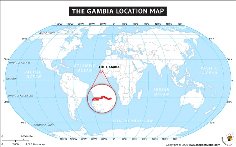
Where is The Gambia ?
Located in West Africa, The Gambia is almost entirely surrounded by Senegal, except for its 80 kilometers (50 miles) of coastline along the Atlantic Ocean. The Gambia is the smallest country on the African continent, with an area of 11,295 square kilometers (4,007 square miles). The Gambia was named for the Gambia River that flows through it, and over 1,300 square kilometers of the country’s territory is water.
With a latitude entirely between 13° and 14°N, The Gambia is a narrow country not far from the equator. The Gambia has five main and one city: Lower River (Mansa Konko), Central River (Janjanbureh), North Bank (Kerewan), Upper River (Basse), Western (Brikama), and Banjul, the capital city.
The country of Gambia is in the Africa continent and the latitude and longitude for the country are 13.4171° N, 15.9523° W.
The neighboring countries of Gambia are :
Maritime Boundaries
- Cape Verde
Facts About Gambia |
| Country Name | Gambia |
|---|---|
| Continent | Africa |
| Capital | Banjul |
| Largest city | Serekunda |
| Area | 10,689 km2 (4,007 sq mi) |
| Population | 1,882,450 (2013) |
| Lat Long | 13.4667° N, 16.6000° W |
| Official Language | English |
| Calling Code | +220 |
| Time Zone | GMT |
| Airport | Banjul International Airport |
| Neighbour Countries | Senegal |
| Internet TLD | .gm |
| Currency | Dalasi (GMD) |

 The Gambia Distance Calculator and Driving Directions