Smallest State in USA

What is the Smallest State in the United States
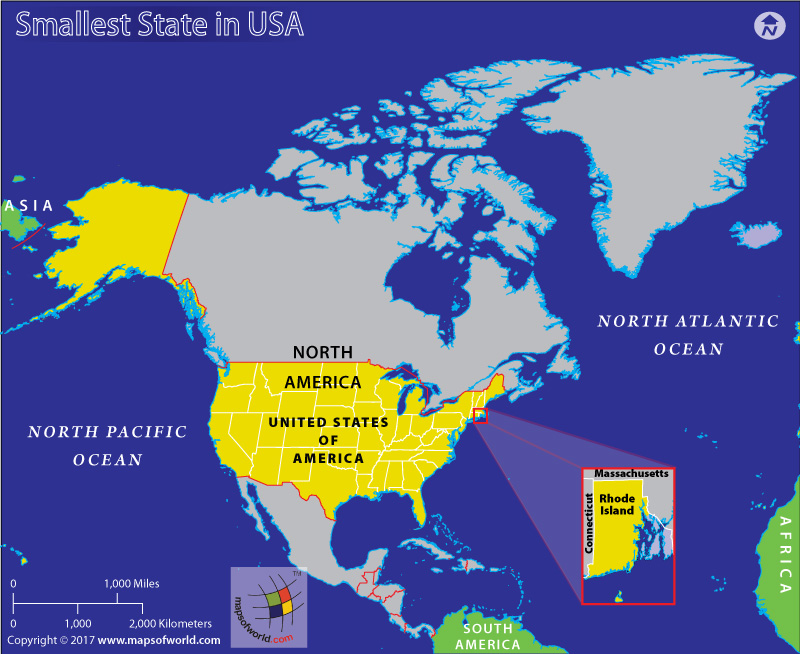
Take a look at the American flag. The fifty stars in the flag represent the fifty states that are now part of the federal union. The thirteen stripes represent the thirteen original colonies that declared their independence from Britain to form the United States. Rhode Island was one of these 13 colonies and is now the smallest of the 50 states (by area). If you want to know about the largest, check out: Largest State in USA.
How Small is Rhode Island
To give us a better idea of the size of Rhode Island, let us look at a few comparisons. Rhode Island is roughly the same size as Yosemite National Park of California. The smallest state of the US thus is nearly twice the size of London and almost the same size as Samoa or Luxembourg.
5 Smallest States of USA – By Area
The 5 smallest states of the USA by area are:
- Rhode Island – 1,544 sq. miles
- Delaware – 2,489 sq. miles
- Connecticut – 5,543 sq. miles
- New Jersey – 8,722 sq. miles
- Hawaii – 10,970 sq. miles
- Rhode Island – Also called the “Ocean State” because, compared to its size, it has the longest saltwater coastline—more than 400 miles of beaches and shores.
- Delaware – The second smallest state after Rhode Island, but it has the country’s lowest corporate income tax rate. Delaware’s compact size doesn’t stop it from being a historical heavyweight. It was the first state to ratify the United States Constitution in 1787, earning it the nickname “The First State.” So, while it might be small on the map, Delaware has a significant place in American history.
- Connecticut– Despite its small size, Connecticut is one of the wealthiest states in the U.S. and is known for its high standard of living. The state has a strong economy, driven by industries such as finance, insurance, and healthcare.
- New Jersey – New Jersey boasts the 11th highest population, proving it can pack a lot into a small space. It may be small, but it’s home to the longest boardwalk in the world at Asbury Park, stretching for 5.5 miles.
- Hawaii – The 50th state and one of the smallest in terms of land area, it boasts the southernmost point in the United States. The southernmost tip of the Big Island, known as South Point (Ka Lae), is the most southern point in the entire country.
5 Smallest States of USA – By Population
The 5 smallest states of the USA by population (2023) are:
- Wyoming – 584,060
- Vermont – 647,460
- Alaska – 733,400
- North Dakota – 783.930
- South Dakota – 919,320
- Wyoming – Wyoming has few people, about 1.13 per sq km, making it the emptiest U.S. state. Over 60% of Wyoming’s population resides in rural areas, compared to the national average of 19.3%.
- Vermont – Vermont, with 643,077 people, is growing steadily, defying the trend of rural decline in other parts of the country. Vermont remains predominantly rural, with over 67% of residents living outside urban areas.
- Alaska – Alaska has vast wilderness due to low population density. Alaska’s population makeup is diverse, with over 18% identifying as Alaska Native or Native American, 5.8% Asian, and 6.5% Hispanic/Latino.
- North Dakota – North Dakota’s population has steadily grown, exceeding 779,000 in 2022. This modest but consistent rise is fueled by a strong agricultural economy, energy exploration, and affordable living, attracting young families and entrepreneurs.
- South Dakota – Defying national trends, South Dakota’s Black Hills region, fueled by tourism, healthcare, and tech, saw a 10% population surge, bringing fresh blood while preserving rural roots.