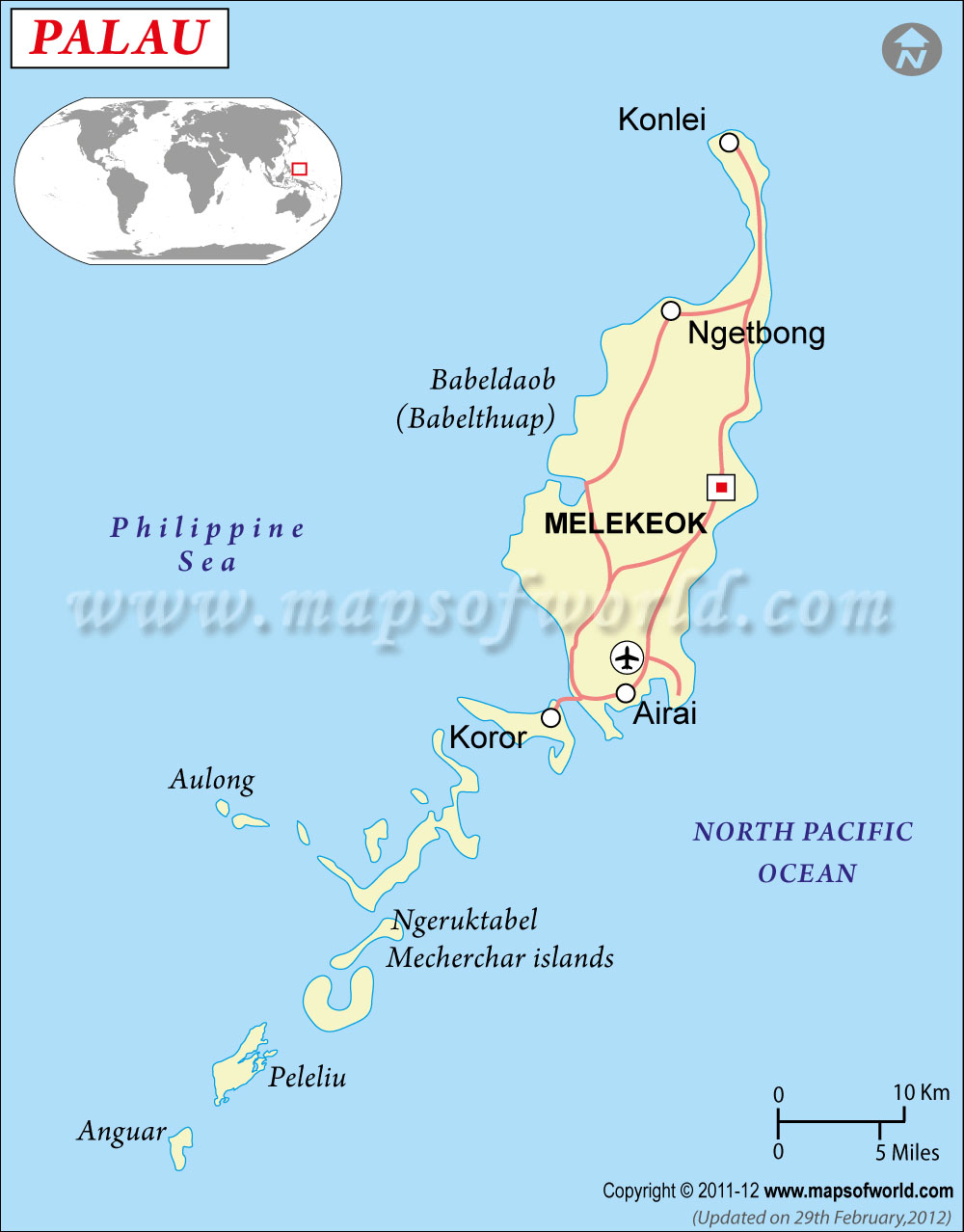
Palau Map

- Continent And Regions - Oceania Map
- Other Palau Maps - Where is Palau, Palau Cities Map, Palau Road Map, Palau Flag
About Palau
Explore this Palau map to learn everything you want to know about this country. Learn about Palau location on the world map, official symbol, flag, geography, climate, postal/area/zip codes, time zones, etc. Check out Palau history, significant states, provinces/districts, & cities, most popular travel destinations and attractions, the capital city’s location, facts and trivia, and many more.
| Full name | Republic of Palau |
| Capital City | Koror |
| Language | English, Palauan, Japanese |
| Currency | US Dollar |
| Religion | Christian, Modeknegi |
| National Anthem | “Belau loba klisiich er a kelulul” |
| Newspaper | EIN News, Inside Palau, One World, Topix etc are online newspapers of Palau. |
| Places to Visit | Babeldaob, Koror, Badrulchau, Blue Corner, Peleliu and many more interesting places are there in the country. |
| Transport | Airways:Far Eastern Air Transport, Continental etc offer frequent fklights between various places. Waterways: boats are also available. |
| Shopping | Local handicrafts such as woodcarvings, storyboards, bais, canoes, beautiful sculptures or dilukai etc are found in this country in cheap prices. Besides these jewelry, baskets, etchings, hats, purses, mats made of pandanas, palm etc are also found here. |
In the prehistoric era, the inhabitants of Palau originally came from Polynesia, Australia and Asia. Visit this island nation and be enthralled by its natural beauty.
Location Of Palau: Palau is located in the Pacific Ocean. Philippines is a neighboring country of Palau that lies in the western side of the island nation. The Philippines were originated from the trusteeship of United Nations. Its administrator is United States.
Physical Map Of Palau : The Republic of Palau is an archipelago made of six groups of islands. There are about 300 islands in those groups. Various mountains, lowlands, highlands etc cover the surface of the land of Palau. The main island is called Babelthuap and is full of mountains ranges. Coral islands and rock islands are also seen. The highest altitude of the country is the Mount Ngerchelchuus peak that rises almost 242 meters above the sea level.
Climate Of Palau : Palau has a tropical climate. The temperature swings between 20°C and 30°C throughout the year. The climate of Palau is usually humid and warm. During the months between May and November, you can face heavy rainfall. Thunderstorms are often seen in the month of June. On the other hand the months of February and March are known for arid climate. Be prepared for occasional typhoon attacks.
Flora And Fauna Of Palau :
• Flora : The flora of Palau is diverse and rich with various unique species. The mangrove forests are seen in large numbers. In these forests you can find trees like savanna land, swamps, etc. Besides that, towards the highlands, you can find rain forests. Taros, sweet potatoes, cassavas, papayas, coconuts, bananas, citrus fruits, etc are found in the forests of Palau.
• Fauna : Similarly the animal kingdom of Palau is also diverse. Sea animals are found in large number. Some these are tropical fish, coral, anemones and so on. Besides that sea turtle, dugong, sea cow etc are also found in Palau.
People of Palau : The total population of the Republic of Palau is almost 18,400. The Palauan people form the majority of the entire population. The minorities are Filipino, Chinese and other races of Asia, Carolinian, and Micronesian etc. The official language of the country is Palauan. However Angaur, Filipino, English, Chinese, Japanese, Carolinian etc languages are also spoken in various parts of the country.
Arts, Culture and Music of Palau :
Art : Art is given very much importance in Palau. Carvers, shell jewelry, weavers etc are practiced in various regions of the country. Painting is also a very popular art form. Besides that some local handicrafts also exists in Palau.
Culture : In the presence of various ethnicities, Palau has formed a rich culture. Dance and music are considered as two very important aspects of Palauan culture. Various festivals and rituals have been adopted from the different races and tribes in Palau.
Music : In the music of Palau, great influence of United States and Western Europe and Japan is felt. In modern generation is inclined towards pop music. Besides that Palauan country music and folk music are also very popular.
Flag of Palau The flag of Palau is really beautiful. The base color of the flag is light blue and it bears a yellow disk. The disk is positioned in the center of the flag, stretched a little towards the hoist side. The yellow circle signifies the moon, which is a symbol of peace. The blue field does not symbolize the Pacific Ocean. Rather is the symbol of political independence.
Economy of Palau : The three primary aspects of the economy of Palau are tourism, agriculture and fishing. The natural resources of the country are gold and other minerals, forests etc. The agricultural products are copra, coconuts, tropical cassava, sweet potatoes and so on. Some of the industries that are growing largely in this country are tourism, craft items made of shell, wood, pearls etc. The primary export commodities are shellfish, copra, tuna, garments and so on. US, Singapore and Japan are the nations that take part in this export trade with Palau.