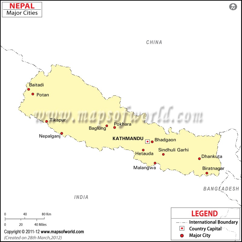
Nepal Major Cities Map

Nepal cities are all picturesque in their own way and each one has their own unique beauty that makes all of them worthy of visit. Nepal cities are blessed with rivers, mountains, glaciers, lush green meadows, valleys which make the Cities of Nepal heaven on earth.
The Cities in Nepal offer something or the other to its tourists. Adventure seeking people have the opportunity of trekking the slopes of Himalaya. It also an ideal place for those who want to spend time in the tranquility. Nepal is famous for its seven Heritage sites which draw thousands of tourists from different places of the world.
In the picturesque valley of Kathmandu, lie the three beautiful cities Kathmandu, Bhaktapur and Patan. Kathmandu is the capital of Nepal. Each city has its unique characteristic. For example, Kathmandu is the commercial and business hub of Nepal, Patan is famous for silverware and bronze, while Bhaktapur, known as the temple city. It is full of temples and heritage buildings like old palaces which are still preserved as heritage buildings. 55 Windows, the Golden Gate, Dattatreya Square, Nyatapola Temple, and other historic monuments and heritage sites are visited by many. Again Lumbini , famous for birth place of Lord Buddha is visited by not only Buddhists but many tourists of the world.
Regions and Cities of Nepal include five development regions and nine major cities. The Regions and Cities are Everest region, Kathmandu region, Pokhara region, Langtang region, Annapurna region, Arun valley, Terai valleys, Dolpa, Dhaulagiri Himalaya, Mahakali river regions, Ilam, Jumla region and the cities of Kathmandu, Biratnagar, Bhaktpur, Dharan, Birgunj, Patan, Nepalgunj, Namche Bazaar and Pokhra.
The regions of Everest, Kanchenjunga, Arun valley and Ilam come under the Eastern region of Nepal. The regions of Pokhra and Annapurna lie in the Western Nepal, while the regions of Kathmandu, Dolpa, Dhaulagiri Himalaya, Jumla and inner Terai valleys are located in the Mid Western Nepal and Langtang in the Central Nepal and the regions of Mahakali River in the Far Western Nepal.
Among the cities of Nepal, Kathmandu is the capital city as well as the cultural center of Nepal, Biratnagar is the political capital. Bhaktpur, the historical city, is famous for its art of pottery making. Birgunj is the business center, while Namche Bazaar is famous among the trekkers for its Sherpa settlement. Patan is the center of metallic work and Nepalgunj is renowned for housing the Bardiya National Park.
Other Regions and Cities at Nepal are Achham, Aiselukharka, Amardaha, Amile, Amariya, Bachhuwa, Bagar, Bagarchhap, Bahasi, Bela, Bhada and Bogri. The tourist attractions of the Regions and Cities of Nepal include the Royal Chitwan National Park, Daman, Khumbu, Dhorpatan, Nagarkot, Rara Tal, Lumbini, Haleshi, Boudhanath Stupa, Dakshinkali, Pashupatinath temple, Muktinath and Parping.