logo


Anguilla Latitude and Longitude Map

Anguilla's latitude and longitude is 18° 15' N and 63° 10' W. Below is the map of Anguilla showing major towns, roads, airports with latitudes and longitudes plotted on it.
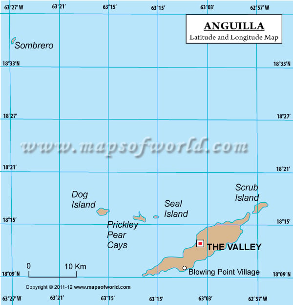
Anguilla Latitude and Longitude Map
Description : Find Anguilla latitude and longitude map showing comprehensive details including cities, roads, towns, airports and much more. Disclaimer
×

Disclaimer  :  All efforts have been made to make this image accurate. However MapSherpa, Inc, its directors and employees do not own any responsibility for the correctness or authenticity of the same.


Search For Latitude & Longitude Map

By Country

Or

Latitude

Longitude

Or

Area

* Put South & West values with minus ( - ) sign.


The latitude and longitude of Anguilla is 18º 15' N and 63º 10' W respectively. It is located in Caribbean Islands and lies on the eastern side of Puerto Rico.

The total area is about half the size of Washington DC. The Valley which is the capital of Anguilla lies in 18º 13'N and 63º 04'W latitude and longitude respectively. Anguilla is an overseas territory of UK and hence has no sub-divisions or districts. Anguilla is one hour ahead of Washington DC.

The climate of Anguilla is primarily of tropical nature which is moderated by northeast trade winds. The region of Anguilla is frequently threatened by hurricanes and tropical storms mainly from July to October. The terrain is mainly flat and comprises of low-lying islands of coral and limestone. The total area is 102 square kilometers. The coastline stretches for 61 kilometers. Water supply and distribution is the major concern of Anguilla.

Latitude and Longitude of Anguilla

LocationsLatitudeLongitude
Sombrero18°37'N63°30'W

Last Updated on: November 7th, 2017