What are the Key Facts of Washington?
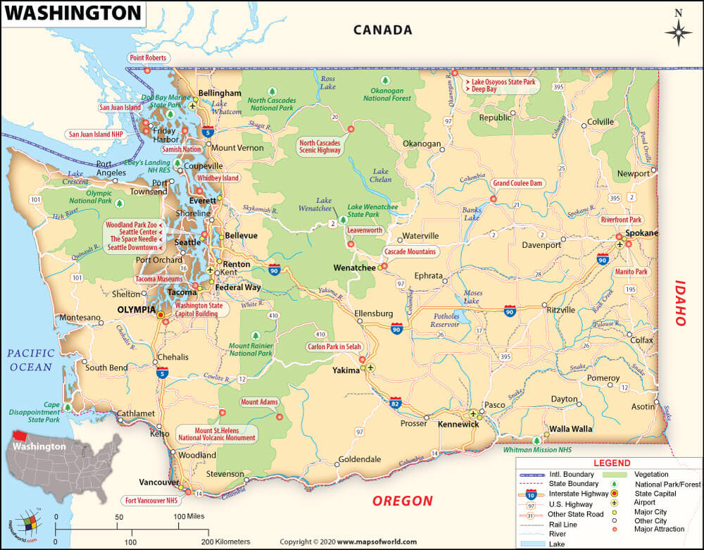
State Washington State Capital Olympia Largest City Seattle Coordinates 47.5°N 120.5°W Nickname(s) “The Evergreen State” (unofficial) Postal Abbreviation WA Area 71,362 sq.Continue Reading…
![]()
State Washington State Capital Olympia Largest City Seattle Coordinates 47.5°N 120.5°W Nickname(s) “The Evergreen State” (unofficial) Postal Abbreviation WA Area 71,362 sq.Continue Reading…
![]()
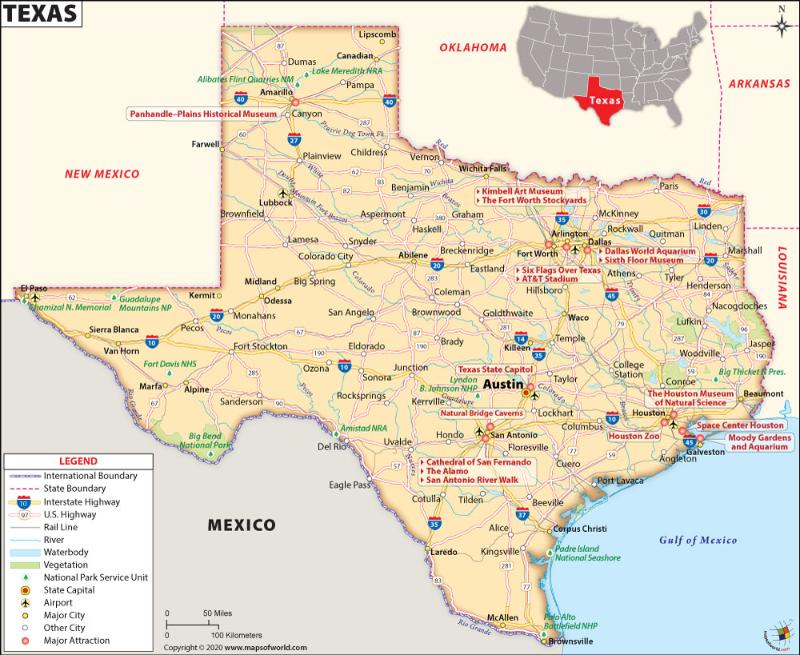
Map of Texas which lies in the South Central region of the USA State Texas State Capital Austin Largest City Houston CoordinatesContinue Reading…
![]()
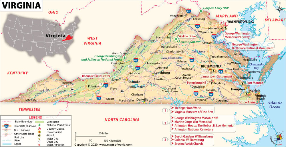
State Virginia State Capital Richmond Largest City Virginia Beach Coordinates 38°N 79°W Nickname(s) “Old Dominion”, “Mother of Presidents” Postal Abbreviation VA AreaContinue Reading…
![]()
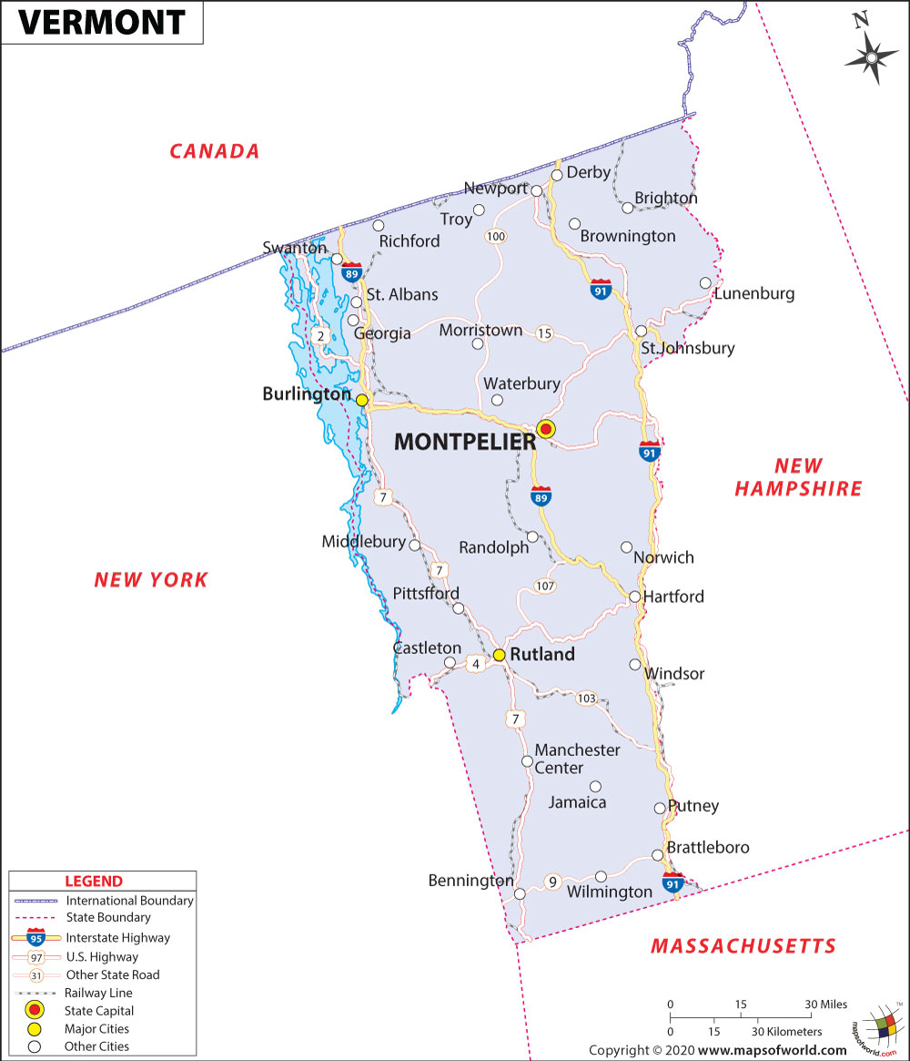
State Vermont State Capital Montpelier Largest City Burlington Coordinates 44°N 72.7°W Nickname(s) “The Green Mountain State” Postal Abbreviation VT Area 9,616 sq.Continue Reading…
![]()
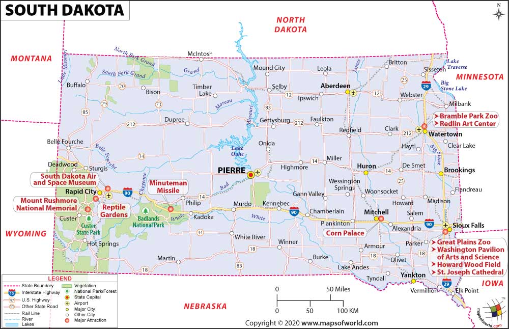
State South Dakota State Capital Pierre Largest City Sioux Falls Coordinates 44.5°N 100°W Nickname(s) “The Mount Rushmore State” (official) Postal Abbreviation SDContinue Reading…
![]()
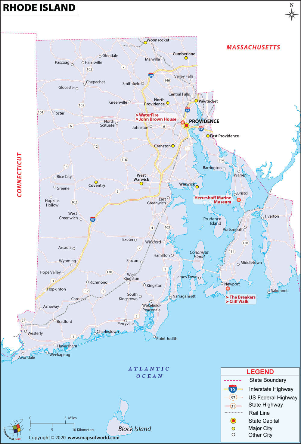
State Rhode Island State Capital Providence Largest City Providence Coordinates 41.7°N 71.5°W Nickname(s) “The Ocean State”, “Little Rhody” Postal Abbreviation RI AreaContinue Reading…
![]()
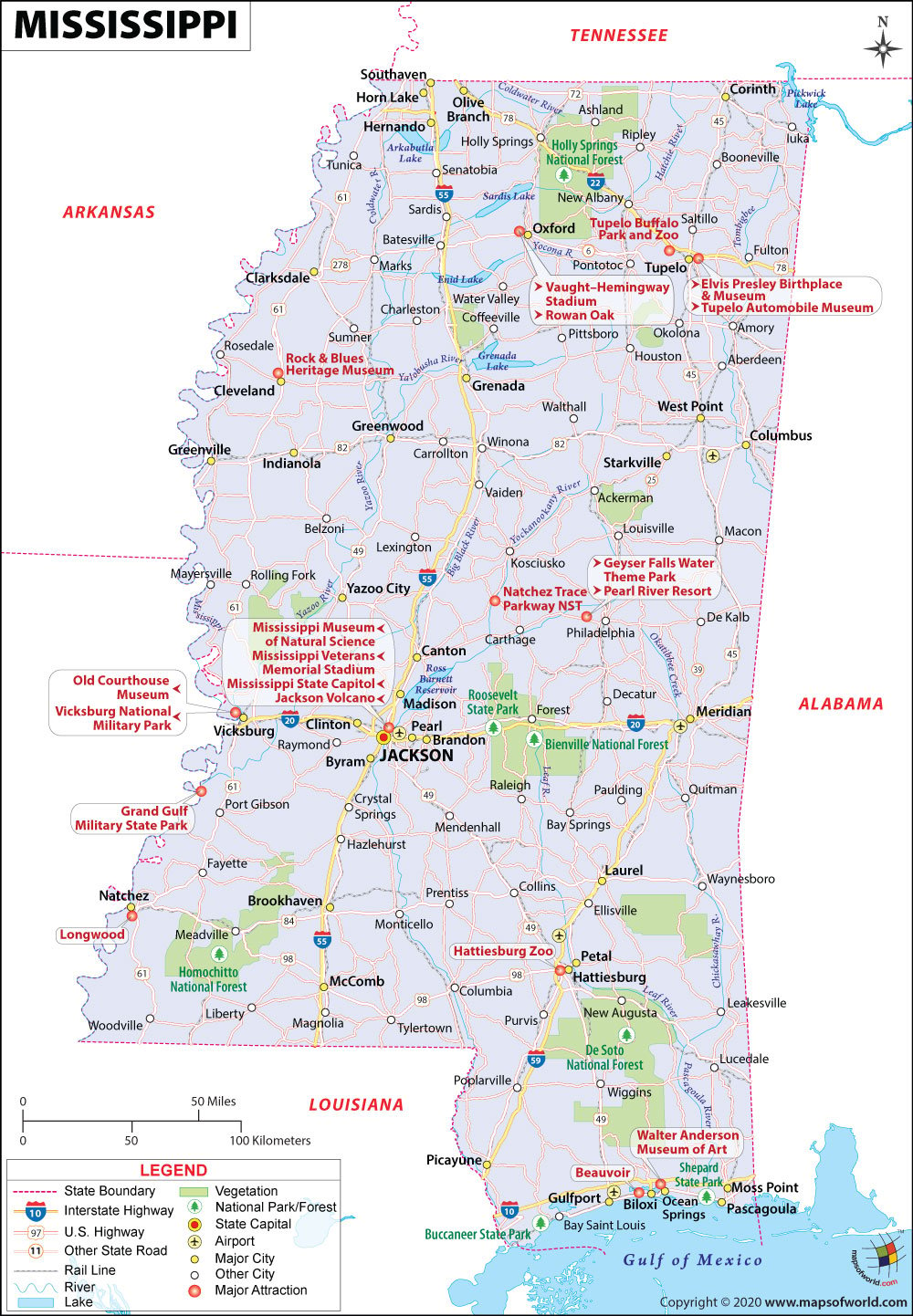
State Mississippi State Capital Jackson Largest City Jackson Coordinates 33°N 90°W Nickname(s) “The Magnolia State”, “The Hospitality State” Postal Abbreviation MS AreaContinue Reading…
![]()