What are the Key Facts of Vermont?

|
State |
Vermont |
|
State Capital |
Montpelier |
|
Largest City |
Burlington |
|
Coordinates |
44°N 72.7°W |
|
Nickname(s) |
“The Green Mountain State” |
|
Postal Abbreviation |
VT |
|
Area |
9,616 sq. mi (24,923 sq. km) |
|
Highest Point |
Mount Mansfield, 4,395 ft (1,340 m) |
|
Neighboring States |
Massachusetts, New Hampshire, New York |
|
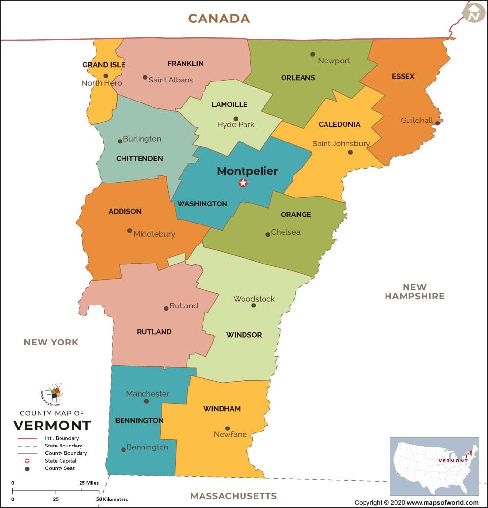
Number of Counties |
14 |
|
Population |
623,989 (2019) |
|
Date of Entering the Union |
March 4, 1791 |
|
State Anthem |
“These Green Mountains” |
|
Governor |
Phil Scott (Republican) |
|
Lieutenant Governor |
David Zuckerman (Republican) |
|
U.S. senators |
Patrick Leahy (Democrats), Bernie Sander (Independent) |
|
U.S. House Delegation |
Peter Welch (Democrats), Patrick Leahy (Democrats), Bernie Sanders (Independent) |
|
GDP (millions of dollars) |
35,271 |
|
Demonym |
Vermonter |
|
Time Zones |
UTC−05:00 (Eastern), Summer (DST) UTC−04:00 (EDT) |
Where is Vermont?
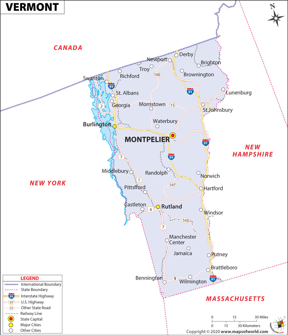
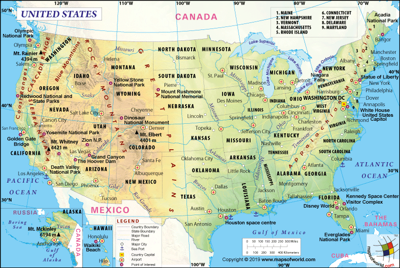
Vermont lies in the northeastern corner of the United States of America. The state was admitted to the union on March 4, 1791, as the 14th state. It is bounded to the north by Quebec, Canada. It is surrounded to the east by New Hampshire, to the south by Massachusetts, and the west by New York. It is the only state in New England that does not touch the border of the Atlantic Ocean.
What is the Geography of Vermont?
Vermont spreads across a total area of 9,616 sq. mi (24,923 sq. km), out of which 9,250 sq. mi (23,957.39 sq. km) is land area and 382 sq. mi (989 sq. km) is water area. Water bodies constitute 4.1% of the total area. The state is in the 45th rank in terms of area of the USA.
The state has an abundance of rivers, but some of them are prominent such as- Connecticut River, Otter Creek, Winooski River, Lamoille River, Missisquoi River, Deerfield River, and many more. The longest river of the state is otter Creek; its length is around 112 miles.
The state’s mean elevation is 1,000 ft (300 m) above sea level. The highest elevation point of Vermont is Mount Mansfield, which is 4,395 ft (1,340 m), while the lowest elevation point of the state is Lake Champlain which is 95 to 100 ft (29 to 30 m).
The state divides into six geographical regions; the Northeast Highlands, the Western New England Upland, the Green Mountains, the Vermont Valley, the Taconic Mountains, and the Champlain Valley.
There are several mountains in the state, but some of the famous mountains of the stare are- Mount Mansfield, Killington Peak, Mount Ellen, Camel’s Hump, Mount Abraham, and many more. Mount Mansfield is the tallest mountain of the state.
It is an estimation that forest covers around 75% of the area of the state. The state’s forests are managed by the Vermont Department of Forests, Parks, and Recreation. Some of the prominent state forests in Vermont are Aitken State Forest, Arlington State Forest, Black Turn Brook State Forest, Boyer State Forest, and many more.
Scientists believe that around 24,000 and 43,000 species of higher plants, algae, fungi, lichens, invertebrates, and vertebrate animals are found in the state.
The state is home to several animal species, including American Marten, Black Bear, Coyote, Eastern Bobcat, Eastern Chipmunk, Eastern Cottontail, Fisher, Gray Fox, etc. Various kinds of birds are spotted in Vermont, such as Hermit Thrush, Canada Goose, Common Nighthawk, American Coot, and many more.
Sugar maple is the state tree of Vermont, while Red Clover is the state’s flower. Apart from this, the Morgan horse was adopted as the state animal in 1961, and Hermit thrush is the state bird of Vermont.
What is the Climate of Vermont?
The state has a humid continental kind of climate. Summers are generally hot and warm while the state experiences cold and snowy winters.
The average summer temperature of Vermont varies between 75°F (23.9°C) to 82°F (27.8°C). However, the night temperature in summer dips around 55°F (12.8°C) to 60°F (15.6°C). The winter season of Vermont is frigid and snowy; the average temperature in severe cold remains between 2°F (-16.7°C) to 12°F (-11.1°C) range in several parts of the state. Thunderstorms are frequent in Vermont during late spring and early summer. Snowstorms occur in the state during winter.
Rainfall takes place throughout the year in Vermont, but the state gets more rain in spring and early summer. It receives an average annual rainfall of 50 inches (1270mm) and receives average snowfall around 80 inches (2032mm) to 100 inches (2540mm) during the winter. July is the hottest month of Vermont, while January is the coldest month of the state. The state experiences the average annual sunshine of 2295 hours.
What is the Economy of Vermont?
The economy of the state depends on the service sector. This sector generates maximum employment in the state. Vermont’s business and personal services group is a prominent services group. The primary sources of income of the group are private health care, hotels and resorts, law firms and repair shops, and so on.
Although agriculture still plays a crucial role in Vermont’s revenue generation. The state is famous for the production of dairy products, beef cattle and calves, greenhouse and nursery products, hay, chicken eggs, turkeys, and maple products. The state has a respectable place in the production of Vermont cheddar cheese, maple syrup, and the mouth-watering Ben and Jerry’s ice cream.
Honey and aquaculture are also crucial to the state for generating income. However, the state’s maximum revenue from agriculture products is by the sale of dairy products.
The state is famous for wood and paper products such as hockey sticks, furniture, different types of papers, etc. Printing is another primary industry in the state.
The production of electrical equipment (semiconductors, electrical components) is one of the most popular manufacturing activities of Vermont.
The state is known for mining products such as limestone, marble, sand and gravel, slate, and talc. The total Gross Domestic Product (GDP) of the state was the U.S. $ 34,785.1 in 2019, while the per capita personal income of Vermont was 56,691 US dollars in 2019.
What is the Transportation System of Vermont?
The Vermont Agency of Transportation manages all the transportation networks in the state, such as developing and maintaining roads, bridges, railroads, airports, park-and-rides, bicycles, and pedestrian facilities. The state highways have been kept into three categories-Interstate Highways, U.S. Highways, and Vermont routes.
Some of the important Interstate Highways are I-91, I-93, I-189, I-289, etc. At the same time, prominent U.S. Highways are- US-2, US-4, US-5, and so on. However, major Vermont routes (state highways) are- VT-2A, VT-2B, VT-3, VT-4A, and so on.
The Vermont Agency of Transportation Rail Programme manages the state’s rail network. It ensures a safe and well-planned movement of goods and passengers throughout the state.
The state is well connected by air. The state has several airports, some of the major one’s are- Burlington International Airport, Rutland – Southern Vermont Regional Airport, Edward F. Knapp State Airport, General Aviation airports, etc.
What is the Origin of the Name of “Vermont”?
French explorer Samuel de Champlain had mentioned the Green Mountains of Vermont “Verd Mont” (green mountain) on his 1647 map. Therefore, Vermont is an English form that emerged from the French word “Verd Mont”.
Why is Vermont called “The Green Mountain State”?
Vermont’s state nickname is “The Green Mountain State”. The name derives from two French words, “Verd (green) and Mont (mountain), which is the explanation of the state’s nickname, the “Green Mountain State”. At present, this nickname can be seen on Vermont license plates.
What are the Popular Tourist Attractions in Vermont?
The state is packed with several remarkable tourist attractions. Children never forget to visit Ben & Jerry’s factory, an excellent spot to visit for people of all ages. The popular tourist attractions in the state are Green Mountain National Forest, Lake Champlain, Stowe, Shelburne Museum, Hildene, Church Street Marketplace, Ben & Jerry’s, Brattleboro Farmers’ Market, and many more. It is a place where tourists can enjoy a lot.
Facts About Vermont
1.The Green Mountain State is the other name of Vermont.
2.The state has earned a substantial amount of acclaim for its maple syrup.
3.The officially recognized fair of Vermont is staged in Rutland. The event is organized every September.
4.Mount Mansfield has a height of 4,393 feet. It is the tallest location in the state.
5.In 1609 Samuel de Champlain went around Vermont and claimed ownership of the state as a representative of France.
6.It was in 1724 that the English settlers turned up at the state.
7.Vermont became a part of USA on 4th March 1791. It was the 14th state.
8.The French words verts monts signify mountains that are green in color. These are the source word for the state’s name.
9.The earliest indigenous tribes to have resided in Vermont are Abenaki, Penacook and Mahican.
10.Of all the state capitals in USA, Montpellier has the slightest population.
11.Freedom and Unity is the officially accepted motto.
12.Sugar maple is the officially recognized tree.
13.Apple is the officially acknowledged fruit of Vermont.
14.Washington is the state’s geographic center.
15.Fort Ste. Anne was set up in 1666. It was the earliest French establishment in Vermont.
16.The earliest constitution was accepted in 1777.
17.Phish, a famous rock music outfit started its career in Burlington.
18.IBM and Ben & Jerry’s are the largest providers of jobs in the state.
19.Crown Point and Fort Ticonderoga were won by the Green Mountain Boys, who were helmed by Ethan Allen, in 1775. It is regarded as an important victory at the time of the American Revolutionary War.
20.New York and New Hampshire have laid claim to the state at various occasions.


