Largest Peninsula in the World
Peninsulas are made in different ways by nature. Stuff like erosion, when wind and water wear away the land, and tectonic activity, which is when Earth’s plates move around, help shape them. In this article, we will learn about the peninsulas, largest peninsula in the world, where it is, and the facts about it and more.
What are the Peninsulas?
Peninsulas are pieces of land that stick out into the water and are surrounded by water on three sides. They come in different sizes, from small to big ones, some peninsulas are small enough to be home to just a lighthouse. Usually, they’re attached to a larger piece of land by a narrow strip called an isthmus. Peninsulas are everywhere in the world, They often have special plants and animals.
World’s Largest Peninsula
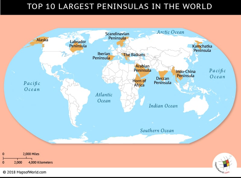
The largest peninsula in the world is the Arabian Peninsula. It’s huge, covering about 3.2 million square kilometers (around 1.25 million square miles). Lots of countries are on it, like Saudi Arabia, Yemen, Oman, United Arab Emirates, Qatar, Bahrain, and Kuwait. This place is famous for its enormous deserts, like the Rub’ al Khali, also known as the Empty Quarter. It’s full of sand and one of the largest deserts on Earth. The Arabian Peninsula is also important because it has lots of oil underground.
Where is the Arabian Peninsula?
The Arabian Peninsula is a big piece of land in Southwest Asia, situated northeast of Africa on the Arabian Plate. It’s like a triangle, with its base at the top and its pointy end pointing downwards. On the west side, it’s next to the Red Sea, on the south side, it’s next to the Arabian Sea, on the northeast, it’s next to the Persian Gulf, and on the southeast, it’s next to the Gulf of Oman. The top part of the peninsula connects to the rest of Asia through a thin strip of land in Egypt called the Isthmus of Suez.
Top 9 Largest Peninsulas in the World
The nine largest Peninsulas apart from the Arabian Peninsula are:
-
Iberian Peninsula
The second largest peninsula in the world is the Iberian Peninsula. It sits in southwestern Europe, bordered by the Atlantic Ocean to the west and the Mediterranean Sea to the east. The Pyrenees Mountains hug the peninsula to the northeast.
-
Alaska Peninsula
It is in the southwestern part of Alaska, surrounded by the Bering Sea to the north and the Pacific Ocean to the south.
-
Yucatán Peninsula
Found in southeastern Mexico, it separates the Caribbean Sea from the Gulf of Mexico.
-
Scandinavian Peninsula
Located in Northern Europe, bordered by the Norwegian Sea to the west and the Baltic Sea to the east.
-
Italian Peninsula
The Adriatic Sea borders the peninsula to the east, while the Tyrrhenian Sea borders it to the west, and the Ionian Sea to the south.
-
Malay Peninsula
Situated in Southeast Asia, bordered by the Strait of Malacca to the west and the Gulf of Thailand to the east.
-
Deccan Peninsula (India)
In South Asia, the Deccan Peninsula situates itself, surrounded by the Arabian Sea on the west, the Bay of Bengal to the east, and the Indian Ocean to the south.
-
Indochinese Peninsula
Located in Southeast Asia, bordered by the Bay of Bengal to the west and the South China Sea to the east.
-
Korean Peninsula
This peninsula in East Asia borders the Yellow Sea to the west and the Sea of Japan (East Sea) to the east.
Related Links