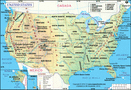
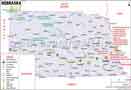
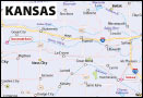
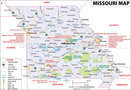
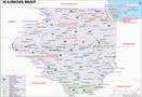
Which US States does the 2017 Eclipse Pass Through?

The total solar eclipse that will take place on August 21st, 2017, and is being referred to as “The Great American Eclipse,” is one of the most awaited events of the year. It is the first eclipse (since 1918) with a path of totality that stretches from the Pacific coast to the Atlantic coast of the United States and makes its landfall within US territory. Though partially visible from many parts of the US and Europe, the eclipse shall be visible in totality from areas of the following US states:
Oregon, Idaho, Wyoming, Nebraska, Kansas, Missouri, Illinois, Kentucky, Tennessee, Georgia, North Carolina, and South Carolina
The path of totality is expected to be about 70 miles wide. The partial eclipse will also be visible from a number of other states including Iowa and Montana. The total solar eclipse is will not last a long time, and eclipse watchers must check their local weather conditions to rule out clouds blocking their view. The greatest duration of the total solar eclipse is expected to be about 2 minutes and 40 seconds (somewhere in the middle of the path of totality, possibly in Illinois). A number of cities along the path of totality are organizing eclipse viewing events and the US expects eclipse chasers from across the world to visit on August 21st, 2017.
A solar eclipse is a natural celestial phenomenon which occurs when the Moon moves between the Sun and the Earth. The Moon, thus, blocks out the Sun’s rays – either partially or completely – casting a shadow on some parts of the Earth.
A total solar eclipse is a rare occurrence and happens only when the Moon is closest to the Earth (a point in its orbit referred to as perigee). The Sun is then completely blocked out by the Moon causing darkness even during the day. The August 21st, 2017, total solar eclipse is the first such occurrence to be visible from the US since July 1991 (which was visible only from parts of Hawaii). The last time a total solar eclipse made its way through contiguous United States was in 1979.
It is important to remember that the solar eclipse should not be viewed with the naked eyes. Various protective gear is available for those keen to view this rare phenomenon.
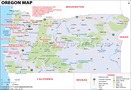
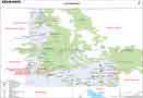
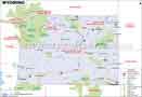
Related Maps: