What are the Key Facts of Kentucky?
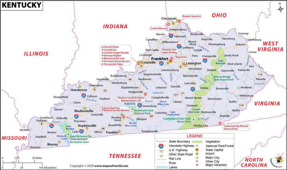
State Kentucky State Capital Frankfort Largest City Louisville Coordinates 37.5°N 85°W Nickname(s) “Bluegrass State” Postal Abbreviation KY Area 40,408 sq. mi (104,659Continue Reading…
![]()
View detailed world maps that offer a global perspective—political, physical, and more.
Explore maps that visualize data on topics like population, climate, economy, and beyond.
Navigate the world with maps that guide your journeys—country and city maps for travelers.
Learn, discover, and share with educational maps, geography trivia, and cartographic insights—ideal for classrooms and curious minds.
FBrowse quick-reference lists for airports, area codes, capitals, postal codes, time zones, and more—organized for easy access.
Explore powerful mapping tools and services.
Order custom maps tailored to your most specific needs, whether for business, education, travel, or more!
Learn moreView detailed world maps that offer a global perspective—political, physical, and more.
Explore maps that visualize data on topics like population, climate, economy, and beyond.
Navigate the world with maps that guide your journeys—country and city maps for travelers.
Learn, discover, and share with educational maps, geography trivia, and cartographic insights—ideal for classrooms and curious minds.
FBrowse quick-reference lists for airports, area codes, capitals, postal codes, time zones, and more—organized for easy access.
Explore powerful mapping tools and services.
State Kentucky State Capital Frankfort Largest City Louisville Coordinates 37.5°N 85°W Nickname(s) “Bluegrass State” Postal Abbreviation KY Area 40,408 sq. mi (104,659Continue Reading…
![]()
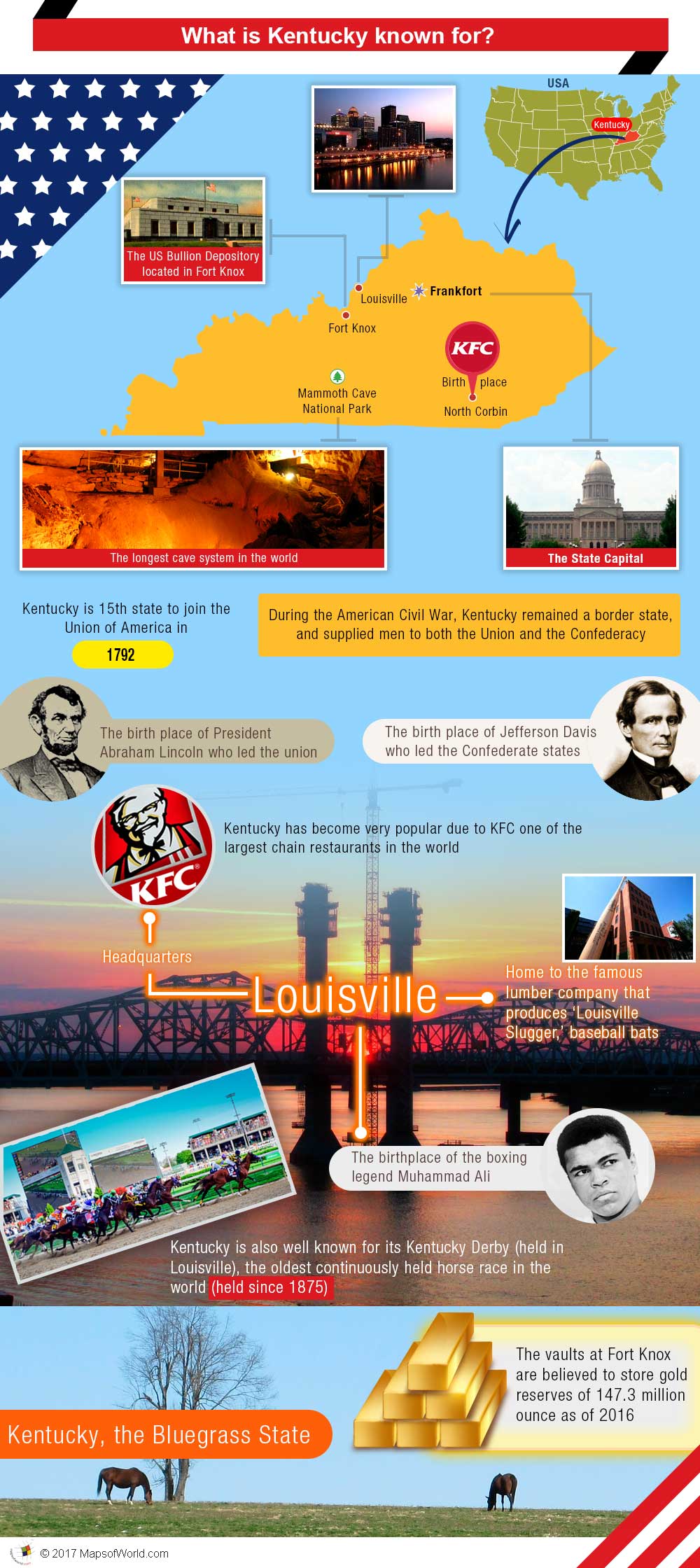
Kentucky, the Bluegrass State, was the 15th state to join the Union (in 1792). During the American Civil War, it remained a borderContinue Reading…
![]()