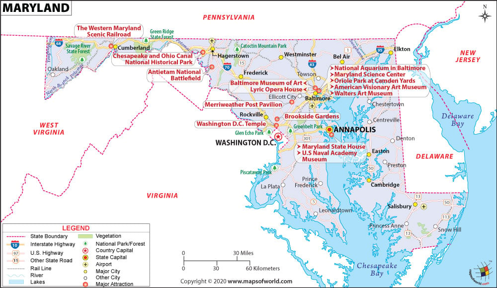
What are the Key Facts of Maryland?
State Maryland State Capital Annapolis Largest City Baltimore Coordinates 39°N 76.7°W Nickname(s) “Old Line State”, “Free State”, “Little America”, “America in Miniature”Continue Reading…
![]()
View detailed world maps that offer a global perspective—political, physical, and more.
Explore maps that visualize data on topics like population, climate, economy, and beyond.
Navigate the world with maps that guide your journeys—country and city maps for travelers.
Learn, discover, and share with educational maps, geography trivia, and cartographic insights—ideal for classrooms and curious minds.
FBrowse quick-reference lists for airports, area codes, capitals, postal codes, time zones, and more—organized for easy access.
Explore powerful mapping tools and services.
Order custom maps tailored to your most specific needs, whether for business, education, travel, or more!
Learn moreView detailed world maps that offer a global perspective—political, physical, and more.
Explore maps that visualize data on topics like population, climate, economy, and beyond.
Navigate the world with maps that guide your journeys—country and city maps for travelers.
Learn, discover, and share with educational maps, geography trivia, and cartographic insights—ideal for classrooms and curious minds.
FBrowse quick-reference lists for airports, area codes, capitals, postal codes, time zones, and more—organized for easy access.
Explore powerful mapping tools and services.
State Maryland State Capital Annapolis Largest City Baltimore Coordinates 39°N 76.7°W Nickname(s) “Old Line State”, “Free State”, “Little America”, “America in Miniature”Continue Reading…
![]()

The Population of Maryland, as per July 1st, 2016 estimate, is 6,016,447 (Six million sixteen thousand four hundred forty-seven). The last officialContinue Reading…
![]()