Historic Route 66
What is Route 66? Known by many nicknames, including the “Mother Road,” “Main Street of America,” and “The Great American Highway,” RouteContinue Reading…
![]()
View detailed world maps that offer a global perspective—political, physical, and more.
Explore maps that visualize data on topics like population, climate, economy, and beyond.
Navigate the world with maps that guide your journeys—country and city maps for travelers.
Learn, discover, and share with educational maps, geography trivia, and cartographic insights—ideal for classrooms and curious minds.
FBrowse quick-reference lists for airports, area codes, capitals, postal codes, time zones, and more—organized for easy access.
Explore powerful mapping tools and services.
Order custom maps tailored to your most specific needs, whether for business, education, travel, or more!
Learn moreView detailed world maps that offer a global perspective—political, physical, and more.
Explore maps that visualize data on topics like population, climate, economy, and beyond.
Navigate the world with maps that guide your journeys—country and city maps for travelers.
Learn, discover, and share with educational maps, geography trivia, and cartographic insights—ideal for classrooms and curious minds.
FBrowse quick-reference lists for airports, area codes, capitals, postal codes, time zones, and more—organized for easy access.
Explore powerful mapping tools and services.
What is Route 66? Known by many nicknames, including the “Mother Road,” “Main Street of America,” and “The Great American Highway,” RouteContinue Reading…
![]()
Flags of the World What was the California Republic? The California Republic was California’s brief stint of independence from both Mexico andContinue Reading…
![]()
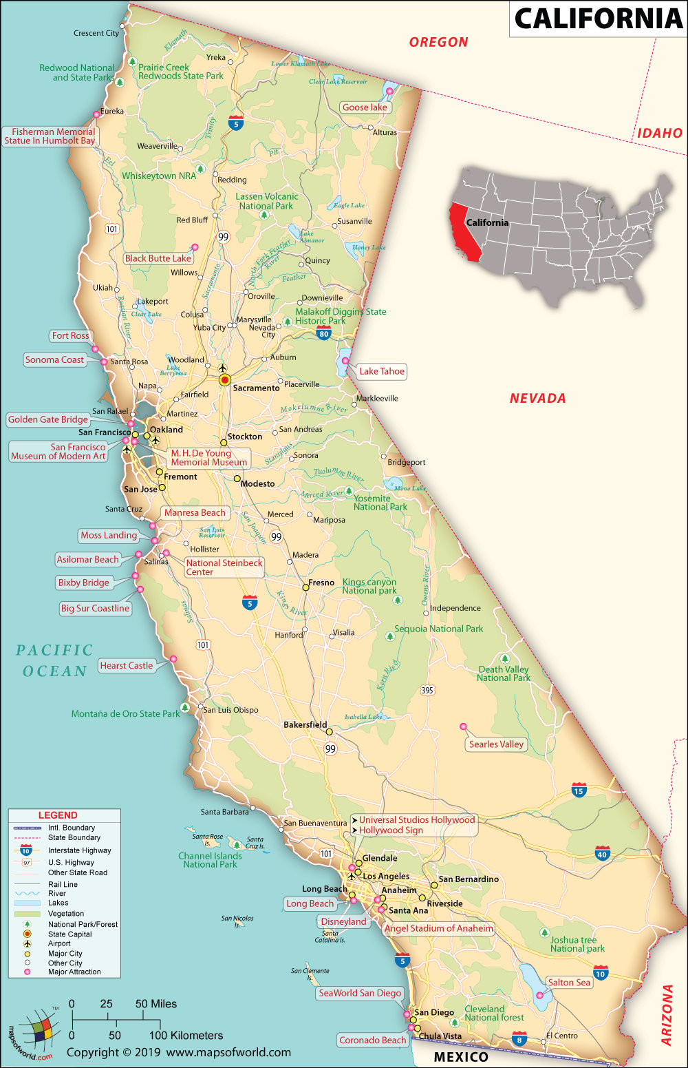
California Facts and Symbols State California State Capital Sacramento Largest City Los Angeles Coordinates 37°N 120°W Nickname(s) The Golden State Postal AbbreviationContinue Reading…
![]()
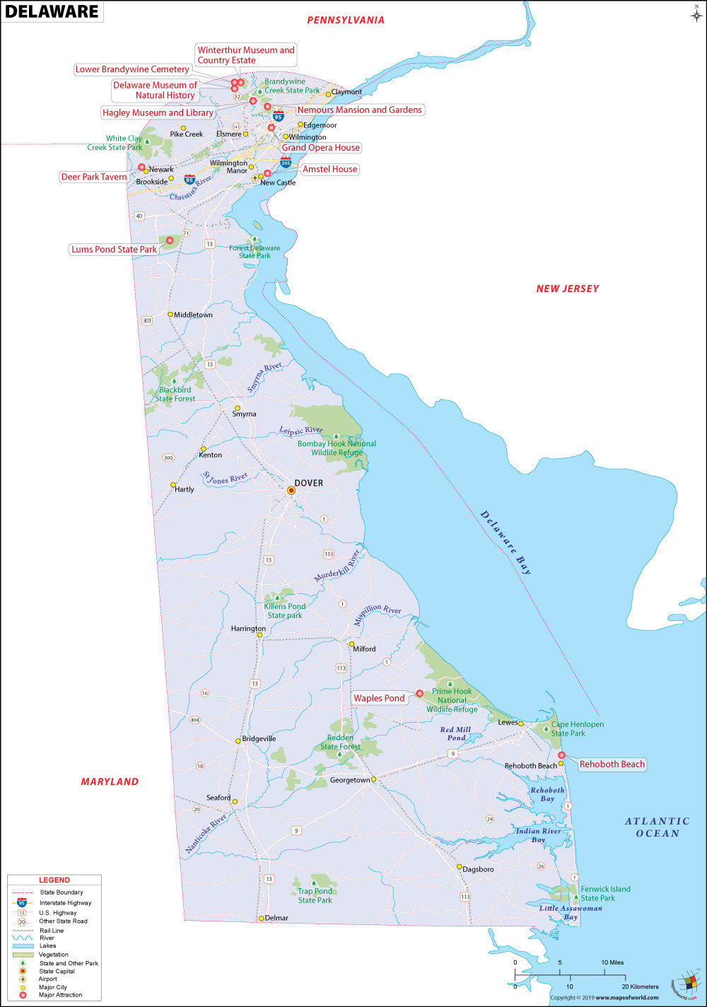
Interesting Facts of Delaware State Delaware State Capital Dover Largest City Wilmington Coordinates 39°N 75.5°W Nickname(s) The First State, The Small Wonder,Continue Reading…
![]()
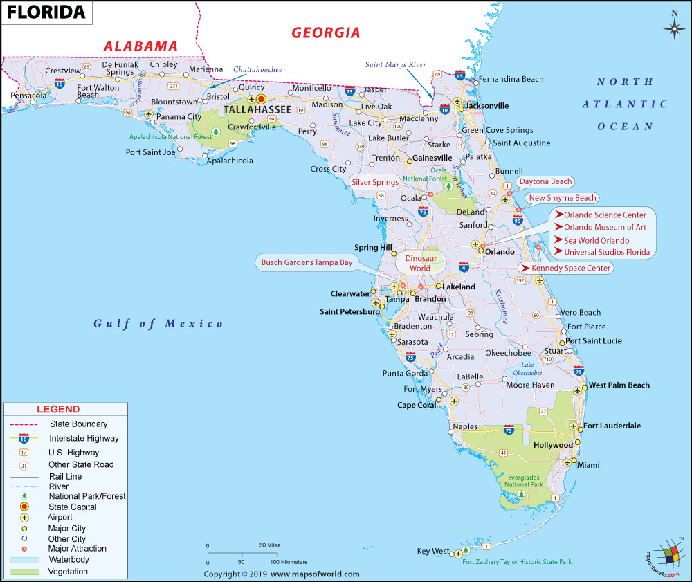
Key Facts Florida State Florida State Capital Tallahassee Largest City Jacksonville Coordinates 28.1°N 81.6°W Nickname(s) The Sunshine State Postal Abbreviation FL AreaContinue Reading…
![]()
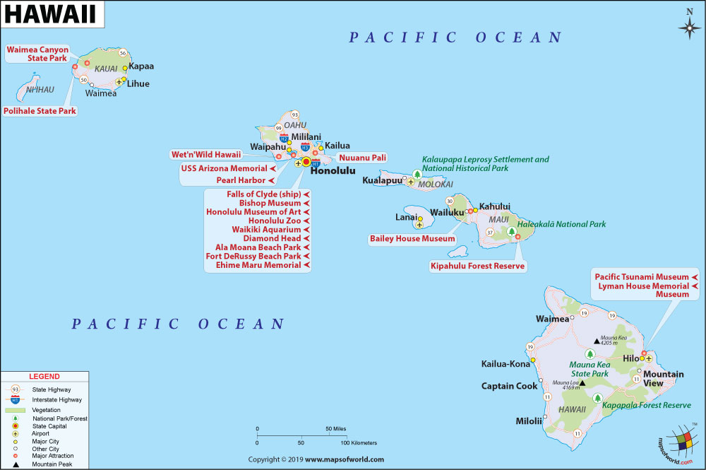
State Hawaii State Capital Honolulu Largest City Honolulu Coordinates 21°18′41″N 157°47′47″W Nickname(s) The Aloha State (official), Paradise of the Pacific, The IslandsContinue Reading…
![]()
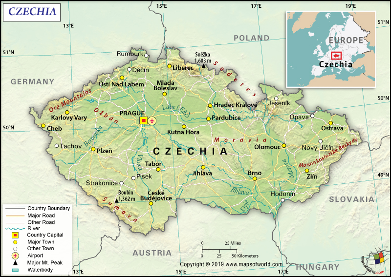
Official Name Czech Republic Continent Europe Capital Prague Largest City Prague Coordinates 49.750000, 15.500000 Area 30,450 sq. mi ( 78,866 sq. km)Continue Reading…
![]()