About Cocos Islands
Explore this Cocos Islands map to learn everything you want to know about this country. Learn about Cocos Islands location on the world map, official symbol, flag, geography, climate, postal/area/zip codes, time zones, etc. Check out Cocos Islands history, significant states, provinces/districts, & cities, most popular travel destinations and attractions, the capital city’s location, facts and trivia, and many more.
Holiday at the land of Cocos (Keeling) Islands, which is even referred to as the Keeling Island, or the Cacos Island. Exploit the scenic beauty of the location and venture to unknown and undiscovered regions that provide worldly pleasures that is beyond one’s imagination. From admiring the beautiful sunsets or catching up with kaleidoscope glimpses of the gracing reefs nestled within the nearby lagoon, capture the real spirits of adventuring in this beautiful island.
Swim along with the friendly dolphins or snorkel while you come across silent stingrays, bike along the west islands, or take a ferry ride to the Home Island, relax by swimming along the Trannies Beach, or reef walk from the Scout park to Pulu Maraya, or simply glance through the Indian ocean and enjoy wonderful sights at its best in the land of diverse opportunities.
Location Of Cocos (Keeling) Islands
The Cocos (Keeling) Island is nestled in center point of the Indian Ocean lying about 2750 km towards the north west part of the Perth region, about 900 km towards the west southwest part of the Christmas Island. This island is placed well in the tropical zone at about 12 degree south and 96.5 degree east.
Physical Map Of Cocos (Keeling) Islands
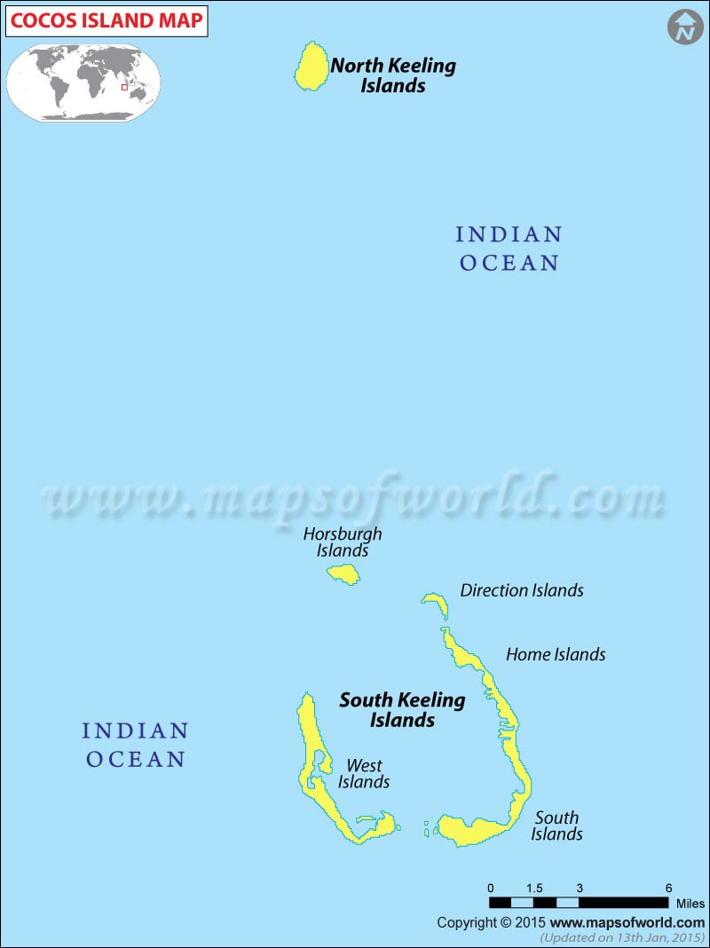
The Cocos (Keeling) Island is divided into two coral atolls namely the North Keeling Island and the South Keeling Island. These are islands that are covered with beautiful cocunut palms all around. The North Keeling island is a C shaped island tht opens to a lagoon which is usually uninhabited.The Pulu Keeling National Park was established here. The South Keeling Island is a home to Home Island natives that reside here within the lagoon shore of South island.
Climate Of Cocos (Keeling) Islands
The two major seasons that overlaps in the Cocos (Keeling) Islands are the trade wind that affect climate thriving from April to October whereas the month of November to April witness’s calm depressions during this time. The months of March to July receive excessive rainfall and January to August is susceptible to low-pressure rarely.
Flora And Fauna Of Cocos (Keeling) Islands
Get outstanding assortment of flora and fauna that dominates within the Cocos (Keeling) Island that exudes an aura of exotic beauty of its own.
There are about 61 different varieties of plants available in this island. Pandanus tectorius cocosensis is among the few that is located in the Home Island and is placed towards the southern end of West Island.
North Keeling Island is proliferating with different species of endemic birds especially the Cocos Buff-banded rail ( Gallirllus phillppensis andrewsi ). Some of the sea birds that are commonly found here are Red-footed booby birds, common noddies, white terns, frigate birds, Rufus Night Heron and White-faced Heron.
This area is widespread with about 500 species of different kinds of fish, different kinds of molluscs, hard corals, crustaceans and echinoderms. The marine life is filled with Turtles, manta rays, nudibranchs and bottlenose and common dolphins that can be sighted quite frequently.
Pulu Keeling National Park is known for preserving endangered wildlife animals and plants of the region of Cocos (Keeling) Island.
Stay connected at Mapsofworld for all relevant information about the Cocos (Keeling) Islands Island.
