1.7K
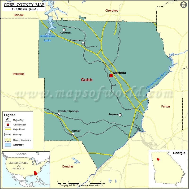
Check this Georgia County Map to locate all the state’s counties in Georgia Map.
Mountain Peaks in Cobb County
| Mountain Peak/Hill | Elevation [Meter] |
|---|---|
| Blackjack Mountain | 418 |
| Cheatham Hill | 342 |
| Kennesaw Mountain | 543 |
| Little Kennesaw Mountain | 488 |
| Lost Mountain | 462 |
| Mount Wilkinson | 299 |
| Pigeon Hill | 379 |
| Pine Mountain | 399 |
| Sweat Mountain | 500 |
Airports in Cobb County
| Airport Name |
|---|
| Calhoun Heliport |
| Cobb County-McCollum Field |
| Cobb General Hospital Heliport |
| Dobbins Air Reserve Base Airport |
| Galleria Heliport |
| Interstate North Heliport |
| Kennestone Heliport |
| Matthews Heliport |
| Smyrna Hospital Heliport |
Cities in Cobb County
| City | Population | Latitude | Longitude |
|---|---|---|---|
| Acworth city | 20425 | 34.056425 | -84.668881 |
| Austell city | 6581 | 33.820256 | -84.645307 |
| Fair Oaks | 8225 | 33.919304 | -84.544439 |
| Kennesaw city | 29783 | 34.026275 | -84.617785 |
| Mableton | 37115 | 33.813222 | -84.565409 |
| Marietta city | 56579 | 33.953164 | -84.542016 |
| Powder Springs city | 13940 | 33.865945 | -84.683699 |
| Smyrna city | 51271 | 33.864095 | -84.516861 |
| Vinings | 9734 | 33.860786 | -84.468615 |
Golf Courses in Cobb County
| Name of Golf Course | Latitude | Longitude |
|---|---|---|
| Atlanta Country Club-Marietta | 33.939104 | -84.422762 |
| Brookstone Country Club-Acworth | 33.994119 | -84.723693 |
| City Club Marietta-Marietta | 33.942082 | -84.552114 |
| Cobblestone Golf Club-Acworth | 34.045301 | -84.666969 |
| Dogwood Golf & Country Club-Austell | 33.850935 | -84.631952 |
| Fox Creek Golf Club-Smyrna | 33.894626 | -84.510112 |
| Indian Hills Country Club-Marietta | 33.960959 | -84.435417 |
| Legacy Golf Links Windy Hill-Smyrna | 33.896651 | -84.498607 |
| Marietta Country Club-Kennesaw | 33.986874 | -84.624126 |
| Pinetree Country Club-Kennesaw | 34.035405 | -84.59205 |
| The Governor’s Towne Club-Acworth | 34.063663 | -84.730511 |
National Parks in Cobb County
| Name of Park | Latitude | Longitude |
|---|---|---|
| Chattahoochee River NRA | 33.986171 | -84.372118 |
| Chattahoochee River NRA | 33.920187 | -84.417107 |
| Kennesaw Mountain NBP | 33.952762 | -84.59318 |
 Wall Maps