

- Nearby National Parks - Shenandoah National Park
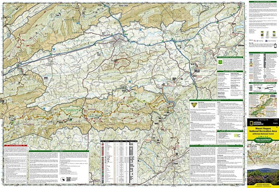
Mount Rogers National Recreation Area is a national recreation area in the United States. Lewis Fork Wilderness is the centrepiece of the National Recreation Area, with a summit elevation of 5,729 feet (1746 m). Mount Rogers National Recreation Area is under the jurisdiction of the George Washington and Jefferson National Forests.
Where is Mount Rogers National Recreation Area
The national recreation area is located in southwestern Virginia near the border with North Carolina and Tennessee.
Wilderness areas within the Mount Rogers National Forest
Mount Rogers National Recreation Area has four federally designated wilderness areas. These four areas together comprise about 18,500 acres of forest. The wilderness areas are:
- Lewis Fork Wilderness
- Little Wilson Creek Wilderness
- Little Dry Run Wilderness
- Raccoon Branch Wilderness
Places to Visit Near Mount Rogers National Recreation Area
- White Top Mountain
- Mount Rogers Scenic Byway
- Settlers Museum of Southwest Virginia
- Grayson Highlands State Park
- Beartree Lake Recreation Area
- Comers Rock Recreation Area
Things to Do in Mount Rogers National Recreation Area
The tourist visiting Mount Rogers National Recreation Area can indulge in various recreational activities. It is a popular destination for outdoor recreation. There are three rental cabins and 11 campgrounds in the Mount Rogers NRA, four of which are set up for horseback riders by the U.S forest service. Some of the popular activities are:
- Bird watching
- Swimming and Boating
- Trout Fishing
- Hiking and mountain biking
- Camping, backpacking and Cabins
- Scenic Drives
- Horse riding and Hunting
- Cross country skiing
Mount Rogers National Recreation Area HIkes
There are over 500 trails available in Mount Rogers National Recreation Area for Hiking inside the region. The national recreation area is considered one of the premier hiking hotspots in the Appalachian Mountains. The national recreation area has 60 miles of the Appalachian Trail, 67 miles of the Virginia Highland Horse Trail and 18 miles of the Virginia Creeper Trail. Some of the famous trails in the recreation and wilderness areas are:
-
Appalachian Trail Whitetop to Fairwood Road:
This 25.1km trail is near Troutdale, Virginia. The best time to visit the trail is March through November. Several shelters exist for thru-hikers.
-
Comers Creek Junction Accessible Fishing Trail:
This is a 1.2 miles long trail tracing Comers Creek, dropping steeply in small cascades and falling into a rhododendron-choked gorge. The path intersects the Appalachian Trail at 4 miles. A narrow road provides visitors access to fishing in the whitetop laurel creek.
-
Virginia creeper Trail
is a 35-mile (56 km) multi-purpose rail trail. The Virginia Creeper Trail is located in southwestern Virginia and runs from Abingdon to Whitetop, Virginia, near Mount Rogers National Recreation Area and the North Carolina state line. The trail accommodates cyclists, hikers and equestrians.
-
Mount Rogers Summit:
This 4.5-mile (7.2 km) trail is the shortest route to the summit of Mount Rogers. The hike is from State Route 600 at Elk Garden or Grayson Highlands State Park.
-
Crest Trail/Appalachian Trail:
The 2.5 miles long trail offers continuous vistas as it courses the top of Pine Mountain.
Facts about Mount Rogers National Recreation Area
- 0n May 31, 1966, Mount Rogers National Recreation Area was designated as a National Recreation Area by the United States Congress.
- The Mount Rogers National Recreation Area is named after William Barton Rogers (the first Virginian State geologist and founder of the Massachusetts Institute of Technology (MIT).
- The Mountain Rogers National Recreation Area and surroundings encompass more than 200,000-acre of mountain land situated roughly between Damascus and Galax.
- Mount Rogers National Recreation Area is home to rare spruce-fir forest, open meadows, forested ridges, wild bears, trout-filled streams, wild ponies and rock prominences.
Best Time to Visit Mount Rogers National Recreation Area
Mount Rogers national recreation forest is a four-season recreation experience. The best time to visit Mount Rogers National Recreation Forest is in summer and Fall weekends and holidays. The national recreation area has the maximum number of visitors at the fall weekends. The Spring Season has wildflowers in bloom, while fall foliage is at its best in mid-October. Cross Country skiers use the trails in Mount Rogers during winters.
Visiting Hours and Tickets of Mount Rogers National Recreation Area
Mount Rogers National Recreation Forest is open year-round, 24 hours a day except on national holidays. One does not need a permit or pass to enter and drive through the Mount Rogers National Recreation Area. A parking fee of $3 per Vehicle is applied to specific recreational areas, payable on the honour system. The visitor Center is open from Memorial Day to October from Monday to Friday, 8 am to 4.
US National Parks Map