

- Nearby National Parks - Manti-La Sal National Forest
Flaming Gorge National Recreation Area
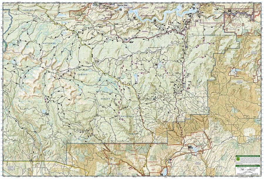
Flaming Gorge National Recreation Area is a United States National Recreation Area with a 91 miles (146 km) Flaming Gorge Reservoir administered by Ashley National Forest. The national recreation area is located in the northeast corner of Utah, about 200 miles from Salt Lake City and the Southwest corner of Wyoming. The Flaming Gorge National Recreation Area is between Rock Springs and Green River and extends into the Uintah Mountains towards Vernal, Utah. The area is a mixture of topography, climate, and recreation opportunities.
Where is Flaming Gorge National Recreation Area
Flaming Gorge National Recreation Area is located in Utah and Wyoming.
Places to Visit Nearby
- Quaint communities of Manila and Dutch John
- Red Canyon Visitors’ Center
- Dinosaur National Monument
- Swett Ranch National Historic Site
- Blue Ribbon-Designated Fishing
- Browns Park
- Flaming Gorge Dam
- Sheep Creek and Spirit Lake Scenic Backways
Things to Do
The tourist visiting Flaming Gorge National Recreation Area can indulge in various activities of Winter and Summer interests. There is plenty of room for everyone according to the interested individual. The national recreation area has 43 Campgrounds hosting 27 group sites and over 700 individual campsites. The region is spread over nearly 91 water miles (with 360 miles of shoreline) plus countless mountain retreats. There are opportunities for setting up “Primitive Camping” and “river camps” for those who want to have more adventure or extend their river runs for more than a day. Some of the popular activities are:
- Water Skiing
- Fishing (trout, Smallmouth bass, Salmon and Channel Catfish)
- Hiking and backpacking
- Boating, Rafting, Canoeing, Kayaking, Parasailing and Paddling
- Mountain Biking (on paved and unpaved roads only)
Hiking Trails
There are numerous trails available in Flaming Gorge National Recreation Area for Hiking inside the park. Some of the famous trails of the national recreation area are:
Red Canyon Overlook via Canyon Rim Trail:
This moderately challenging trail takes an average of 1 hr 51 min to complete. It is one of the most popular trails for walking, hiking and other nature trips.
Dowd Mountain Overlook: It is an 11 miles long trail perfect for biking and hiking enthusiasts. One can experience the beauty of Red Canyon and the Lake.
Sheep Creek Overlook:
This Trail has one of the most famous views in this region. One can have amazing views of Navajo Cliffs with special light effects at dawn and sunset. Majestic Cliffs have stripes of different shades of red, and Plateau seems to emerge from the water.
Kingfisher Island: The Island is only accessible by boat, where one can camp in perfect harmony with nature. Sheep Creek is the nearest boat ramp, less than 3 Km from the Island.
The other trails are Green River Canyon Rim Trail, Red Canyon Rim Trail, Little Hole Trail, Bear Canyon, Greens Lake, Little Hole Trail from Little Hole, Hideout Canyon, and Cart Creek Maintenance Trail, Moose Pond Loop, Lower Little Hole MTB Loop and Swett Ranch Loop.
Facts
- Flaming Gorge National Recreation Area got the name “Flaming Gorge” by John Wesley Powell. It was in 1869 during his expedition down the Green River. The Recreation Area got this name due to gorgeous red sandstone cliffs surrounding the green river.
- The Flaming Gorge National Recreation Area was made National Park Service Responsibility from July 22, 1964, till October 1, 1968.
- In 1964 Flaming Gorge Reservoir was created during the construction of the Flaming Gorge Dam across the Green River.
- The Flaming Gorge National Recreation Area has more than 200,000 land and water.
- Flaming Gorge Dam can produce 50,650 kilowatts of hydroelectric power with three turbines and generators at the base of the Dam.
Visiting Hours
The Flaming Gorge National Recreation Area is open all year round. The best season to visit Flaming Gorge National Recreation Area is summer when the weather is comparatively mild, and it is a pleasant alternative to the plains where it is hot. Summers is the ideal season for Fishing. The best times to visit Flaming Gorge National Recreation Area trails are April through October. The time of the Red Canyon Visitor Center is from 9:00 AM – 6:00 PM daily from Memorial Day Weekend to mid-September. The Flaming Gorge Dam Visitor Center is open from Mid April- Mid-October from April 15 to October 15 from 9:00 AM to 5 PM daily.
Tickets Prices and Permits
Flaming Gorge National Recreation Area does not require entrance fees. A recreation pass is required for the Little Hole National Recreation Trail below the Dam and all major boat launches. Contact Ashley National Forest for Backcountry Camping Permits required in some areas. Permits can be purchased at Kiosks. The Recreation Use Pass is $5 per day, $15 for sixteen days, and $35 annual.
US National Parks Map