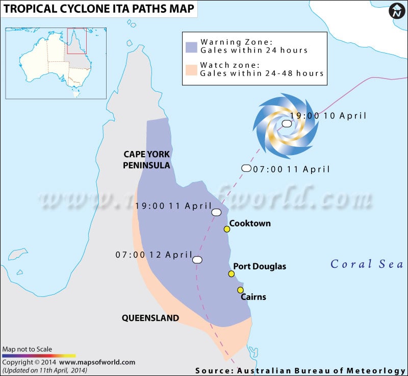
Australia’s Queensland threatened by Cyclone Ita
Australia’s north coast bound state of Queensland has been warned of a highly destructive category-5 storm, according to the Australian Bureau of Meteorology, known as the Cyclone Ita.
As per the Bureau of Meteorology (BOM), heavy rains might cause flooding and the high waves may affect the low-lying areas majorly. The Cyclone Ita is estimated to hit around evening local time (10 hours ahead of GMT), near north-east Queensland’s Cape Flattery.
The Australia Bureau of Meteorology added that, Ita’s 185 mph gusts and 150mph winds (according to the forecast of the Joint Typhoon Warning Center), place it equivalent to a category-4 storm in the US.
The Australia Bureau of Meteorology has issued urgent alerts to the coastal occupants between Cape Melville, Cape Tribulation and Cooktown. They have been advised to be careful and vacate the areas, as the sea level might rise above its normal levels and destructive waves and strong currents are suspected to flood the low-lying areas. The residents have also been warned that the power would be cut off, which might last for a week.
Last week Cyclone Ita was responsible for at least 21 deaths in the Solomon Islands, due to the flash floods caused by the torrential rains.

 Cyclone Preparedness Checklist