5.4K
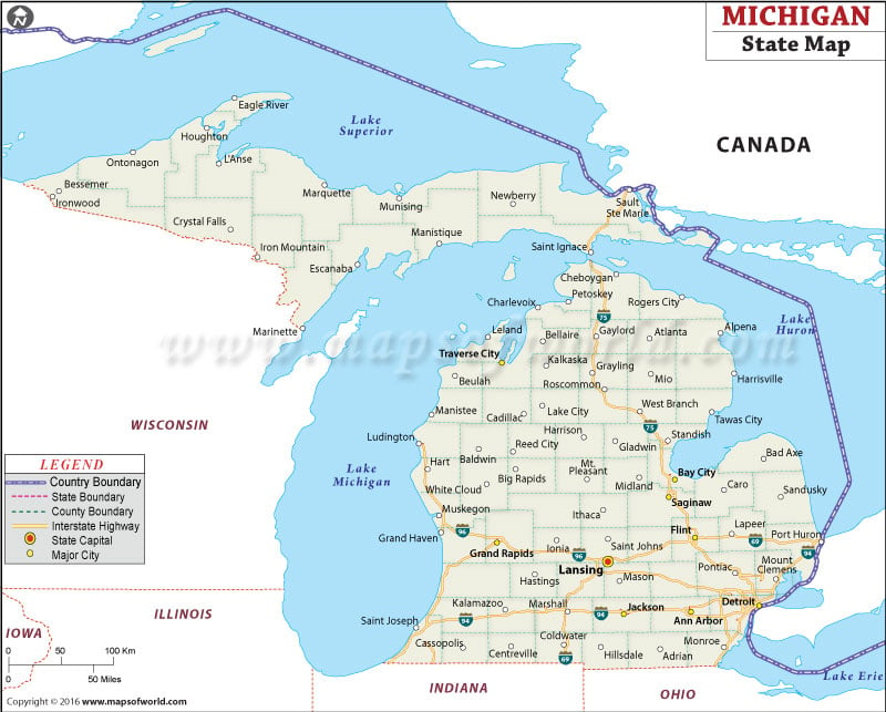
Michigan is a state in the Midwestern USA, bordering Wisconsin, Indiana, and Ohio. The capital of Michigan is Lansing, which is centrally located on the Lower Peninsula. Other major cities in Michigan include Detroit, Ann Arbor, and Grand Rapids.
Major roads traveling across Michigan include Interstate 75, and Michigan Highways 23, 31, 41, and 131.
 Wall Maps