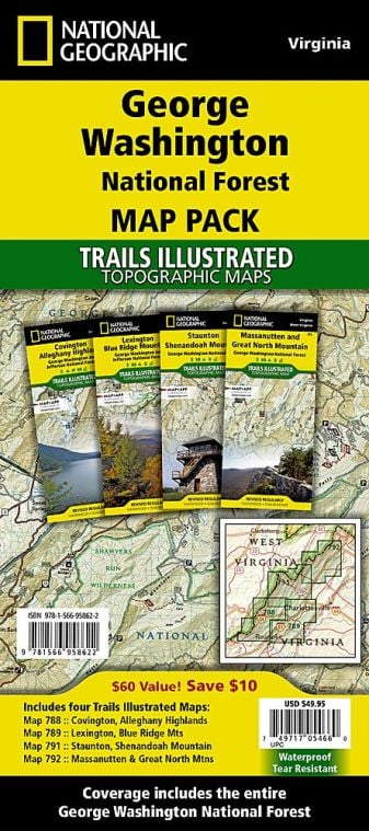
George Washington and Jefferson National Forests are one of the largest areas of public land in the Eastern United States, covering about 1.8 million acres (7,300 km2) of land. The national forest is an administrative entity combining two U.S. National Forest, George Washington National Forest and Jefferson National Forest.
Where are George Washington and Jefferson National Forests
George Washington and Jefferson National Forests are located in the Appalachian Mountains of Virginia, West Virginia and Kentucky. About 1 million acres (4,000 km2) of the George Washington and Jefferson National Forests are underdeveloped and remote.
Wilderness areas in George Washington and Jefferson National Forests
The 139,461 acres (564 km2) of the land of the forests have been designated as wilderness areas, prohibiting future development in the two woodlands under the United States National Wilderness Preservation System. The wilderness areas are:
- George Washington National Forest
- Barbours Creek Wilderness (part)
- Ramsey’s Draft Wilderness
- Priest Wilderness
- Rich Hole Wilderness
- Rough Mountain Wilderness
- Saint Mary’s Wilderness
- Shawver’s Run Wilderness (part)
- Three Ridges Wilderness
Wilderness areas Of Jefferson National Forest
- Barbours Creek Wilderness (most)
- Brush Mountain East Wilderness
- Beartown Wilderness
- Brush Mountain Wilderness
- Hunting Camp Creek Wilderness
- Garden Mountain Wilderness
- James River Face Wilderness
- Lewis Fork Wilderness
- Kimberling Creek Wilderness
- Little Dry Run Wilderness
- Mountain Lake Wilderness
- Little Wilson Creek Wilderness
- Peters Mountain Wilderness
- Shawver’s Run Wilderness (most)
- Raccoon Branch Wilderness
- Stone Mountain Wilderness
- Thunder Ridge Wilderness
Things to Do in George Washington and Jefferson National Forests
Tourists visiting George Washington and Jefferson National Forests can indulge in various recreational activities. Some of the popular activities are:
- Bird watching
- Swimming and Boating
- Trout Fishing
- Hiking and mountain biking
- Camping, backpacking and Cabins
- Scenic Drives
- Horse riding and Hunting
- Winter Sports
- Picnicking and other activities
- Ohv Riding
Hiking in George Washington and Jefferson National Forests
George Washington and Jefferson National Forests have over 2,000 miles (3,000 km) of biking and hiking trails, including some segments of the Appalachian Trail. Hiking in national forests is allowed on open forest roads that are gated to prevent motor vehicle travel. Cross Country hiking is also permitted through the woods.
Day Hikes – George Washington and Jefferson National Forests
The day hiking areas can be divided into the following districts:
-
Clinch Ranger District:
The district is located in the Cumberland Mountains of the Appalachian Plateau in southwest Virginia. The district consists of four campgrounds, lakes and plenty of rivers. Some famous landmarks are the Birch Knob Observation tower and High knob tower.
-
Eastern Divide Ranger District:
some of the popular hiking trails in this district are Boley Field Group Campground, Cascades Day Use Area, Boy Scout Trail and War Branch Trail.
-
Glenwood-Pedlar Ranger District:
Some of the popular trails in this district are Apple Orchards Falls Trail, Belfast Trail and Spy Rock Trail
-
James River and Warm Springs District:
some of the popular trails in this district are Blue Suck Run Trail, Cove Trail, and White Rock Tower Trail.
-
Lee Ranger District:
Some of the popular trails of the district include the Discovery Way Accessible Trail and Little Fort Campground.
-
Mount Rogers National Recreation Area:
Elk Garden Trailhead and Fox Creek Horse Campground are some popular trails.
-
North River Ranger District:
Some of the popular trails in this district include North River Campground, Braley Pond Day Use Area and Shaws Fork Campground.
Backpacking Areas – George Washington and Jefferson National Forests
- Appalachian Trail
- Devil’s Fork Trail
- Spy Rock Trail
George Washington and Jefferson National Forests Facts
- In 1918, Washington National Forest was formed, while in 1936, Jefferson National Forest was established.
- Mount Rogers National Recreation Area, including Virginia’s highest point Mount Rogers, are part of the forest. Other notable features include Whitetop Mountain and Elliot Knob.
- The northern portion of the Blue Ridge Parkway runs through the Washington and Jefferson National Forests.
- The Washington and Jefferson National forests are approximately 230,000 acres (930 km2) of old-growth forests.
- The ghost town of Washington and Jefferson National Forests lies within Jefferson National Forest.
- Breaks Interstate Park, which has the deepest gorge east of the Mississippi River and Roaring Run Furnace (National Register of Historic Places), is located in the Jefferson National Forest.
Best Time to Visit George Washington and Jefferson National Forests
George Washington and Jefferson National forests is a four-season recreation experience. The best time to visit George Washington and Jefferson National forests is from April through November and the best time to hike is when the weather gets a bit cooler and trails are not as crowded.
George Washington and Jefferson National Forests Ticket Prices
George Washington and Jefferson National Recreation Forests are open year-round, 24 hours a day except for national holidays, and one does not require a pass or permits, though Fees are charged at some sites. Some of the recreation activities require a receipt.
- Seasonal Day Use Pass: $30
- America the Beautiful-National Parks & Federal Recreational Lands Annual Pass: $80
US National Parks Map
