
Well into the 20th century the Channel Islands were a real-life version of a John Steinbeck novel, the domain of hearty ranchers, crusty abalone collectors, and eccentric scientists who came to study its natural wonders in splendid isolation. But after most of the archipelago became a national park, other sorts of people began flocking to the islands: nature lovers and outdoor sports enthusiasts bent on discovering a slice of Southern California that hasn’t been paved over or subdivided.
Buy for $14.95
Often called the American Galápagos, the islands and the marine sanctuaries that surround them are an oasis of West Coast flora and fauna. Humpback, gray, blue, and killer whales share the offshore waters with great white sharks and 27 species of marine mammals. Elephant seals and sea lions gather in numbers that reach into the tens of thousands. Nearly 400 avian species have been recorded on the islands, which provide a nesting place for millions of shorebirds. There are endemic species of fox, skunk, mouse, snake, salamander, and lizard. The discovery of mammoth bones in 1994 revealed that island terrestrial life was even more diverse (and much larger) in ancient times.
But the Channel Islands also have their human side. Archaeological evidence proves the islands were occupied as early as 13,000 years ago—the oldest human remains found anywhere in North America were found here. Thousands of Chumash Indians called the islands home when the Spanish arrived; the last native inhabitants were forcibly relocated to mainland missions in the 1820s.
Hacienda life flourished after that, and the tradition lasted until the cusp of the 21st century (see p. 347). Paddlers and photographers, backpackers and scuba divers are today’s denizens, although never in numbers that overwhelm this wild side of southern California.
How to Visit
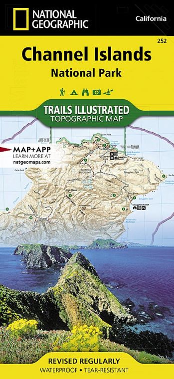
One of the few offshore national parks in the U.S., the Channel Islands are reached by water or air. The water crossing from Ventura, 60 miles north of Los Angeles, is an adventure all its own, with the morning sun breaking up the fog banks that often shroud the islands, and passengers on the lookout for migrating whales and dolphin pods. Most people visit the islands on day trips, with hiking, kayaking, scuba diving, and snorkeling the main activities. Some visitors overnight at one of 60 campsites; others make the long trek to backcountry camps.
Slender Anacapa (one hour by boat), with its historic lighthouse, attracts many visitors, while giant Santa Cruz (one hour by boat), with its spectacular sea caves, surf breaks, and secluded beaches, is the main water-sports hub. Santa Rosa (three hours by boat; 30 minutes by air) is the handsomest, a wilderness of rare trees, white-sand strands, and rocky canyons. Far-off San Miguel (four hours by boat; 40 minutes by air) is renowned for its copious wildlife, while tiny Santa Barbara (three hours by boat) packs a remarkable amount of nature into just 1 square mile.
Information
How to get there
The only way to reach the islands is via concessioner boat, private boat, or small aircraft. Island Packers (island packers.com; 805-642-1393) operates boats to five islands from Ventura and Oxnard. Channel Islands Aviation in Camarillo, CA (flycia.com; 805-987-1301), offers charter flights to Santa Rosa. Several companies also organize guided kayak trips (nps.gov/chis/planyourvisit/ kayaking.htm).
When to go
The park is open year-round, but boats from Ventura Harbor run less frequently between late Nov. and early April. Summer offers ideal camping weather, but spring is best for wildflowers, and fall days can be simply glorious for boating and hiking.
Visitor Centers
The Robert J. Lagomarsino Visitor Center, open year round, is located in Ventura at 1901 Spinnaker Drive, 4.5 miles from the Victoria Avenue exit on U.S. 101. Santa Barbara and Anacapa host visitor contact stations.
Headquarters
1901 Spinnaker Drive Ventura, CA 93001 nps.gov/chis 805-658-5730
Camping
Each of the five islands has a campground (72 sites total) that is open year-round. Backcountry camping is allowed on Santa Cruz and Santa Rosa islands. All camping requires advance reservations (recreation.gov; 877-444-6777).
Lodging
None of the islands offer overnight lodging. Hotels are plentiful in Ventura, (visitventuraca.com), Oxnard (visitoxnard.com), and Santa Barbara (santabarbara.com).
US National Parks Map
About the Guide
