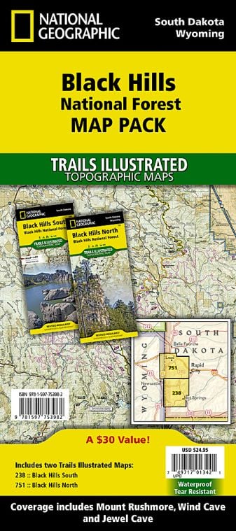
Black Hills National Forest is managed by Forest Service and covers an area of more than 1.25 million acres (5066 km2).
The national forest is approximately 70 miles wide and 110 miles long. The Black Hills National Forest headquarters is situated in Custer, South Dakota. Local ranger district offices of the black hills national forest are located in Custer, Spearfish and Rapid City in South Dakota and Sundance, Wyoming. The black hill national forest lies in the parts of five counties of South Dakota (Pennington, Custer, Lawrence, Fall River and Meade) and parts of two counties of Wyoming (Crook and Weston).
Where is Black Hills National Forest
Black Hills National Forest is situated in southwestern South Dakota and northeastern Wyoming, United States.
Places to Visit Near Black Hills National Forest
- Jewel Cave National Monument
- Mount Rushmore National Memorial
- Black Elk Wilderness
- Custer State Park
- Bear Butte State Park
- Little Devil’s Tower
Things to Do in Black Hills National Forest
Tourists visiting Black Hills National Forest can indulge in various recreational activities. It is a premier destination for outdoor recreation as there are about 30 campgrounds, 11 reservoirs for fishing and many hiking options. There are over 5000 miles (8000 km) of Black Hills National Forest. Some of the popular activities are:
- Wildlife viewing and Bird watching
- Scenic Drive
- Hiking and Mountain Biking
- Fishing
- Ranger-led Programs
- Camping and backpacking
- Picnicking and Naturalist Tours
- Horseback Riding
Black Hills National Forest Hiking
Black Hills National Forest has about 450 miles (725 km) of hiking trails which provide access to more remote destinations inside the forest and the summit of Black Elk Peak. The courses range from easy to difficult in length. Both of the options are available Day Hiking as well backpacking. Some of the marked hiking trails of the National Forest are:
- Flume Trail is a designated National Recreation Trail (11-mile) length and a 22-mile round trip near Rapid City. The trail stretches between Sheridan Lake and Storm Mountain, offering great outdoor activities. At present, historic tunnels and parts of the flume are visible along the trail.
- Crow Peak Trail is a 7-mile (round trip) trail situated west of the northern Black Hills near Spearfish. Once you reach the top of crow peak, you can have spectacular views of Black Hills and prairies to the east. There is also a great view of Bear Butte from the trailhead.
- Horsethief Lake Trail, an a3.5-mile trail, is located west of Mount Rushmore National Memorial, behind a lake of the same name (Horsethief Lake). Along with the track, one can discover waterfalls, mossy boulders, granite spires and some of the giant trees in the Black Hills.
- Cathedral Spires Trail is a 1.5 mile(one-way) trail generally referred to as one of the best climbs in the Black Hills. The trail leads to Cathedral Spires structures and spectacular views of Custer State Park and the prairie.
- Black Elk Peak is one of the most popular hikes in the Black Hills National Forest region. The peak can be reached from two trailheads. One is from Willow Creek to the North, and another is from Sylvan Lake to the South.
Facts about Black Hills National Forest
- Black Hills National Forest is Predominantly ponderosa pine and includes hardwood like aspen, bur, oak and birch.
- Black Elk Peak, the tallest mountain in South Dakota and the highest peak east of the Rocky Mountains in the United States, lies within the Black National Forest.
- The 13,426 acre (54 km2) of Black Elk Wilderness region is a part of Black Hill National Forest, where no motorised Transport is permitted. The activities like mining, logging and ranching are allowed outside the wilderness area.
- The Black Hills National Forest consists of three mountain ranges: the Elk Mountains and the Black Hills in South Dakota and Bear Lodge Mountains in Wyoming. The most extensive range out of the three mountain ranges is black Hills.
- Black Hills National Forest got the name ”Black Hills” from the Lakota word ”Paha Sapa”, which means black hills. The pine-covered hills from a distance appear black.
Best time to Visit Black Hills National Forest
Black Hill National Forest is a four-season recreation experience as it offers something different each time you visit. The best time to see Black Hill National forest is during fall, September or October. Black Hill National Forest is open year-round, 24 hours a day except on national holidays, and one does not require a pass or permits to enter the national forest.
Black Hills National Forest Ticket Prices
The national forest is free of charge. Though Fees are charged at some sites and some recreational activities, they require a permit.
- Seasonal Day Use Pass: $30
- America the Beautiful-National Parks & Federal Recreational Lands Annual Pass: $80
- Annual Forest and Interagency Pass: $55
US National Parks Map
