About North Carolina River Map
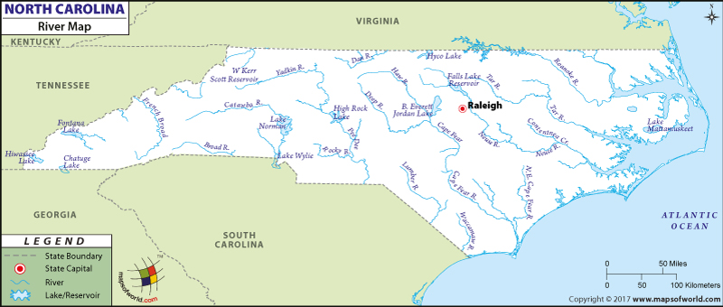
The North Carolina River Map presents a vivid view of all the lakes and rivers of the state. The northern region of the state comes under the watershed of Gulf of Mexico and Continental Divide also intersects this location of the state. The east of North Carolina state is surrounded by the Atlantic Ocean.
Yadkin river, Roanke river and Neuse river are some of the prominent rivers of the state of North Carolina. High Rock lake, lake Gaston and Norman lake are some of the natural lakes in the state of North Carolina. The river map of North Carolina clearly highlights Catawba river, Cape Fear river, Broad river, Chowan river, Lumbe river, Yadkin river, Deep river, Rocky river and French Broad river.
A number of lakes are also indicated in the North Carolina river map. Fontana lake, Lake James, Falls lake, Jordan lake, Hiwasee lake and Lake Norman are depicted in the river map of North Carolina state. All the rivers of North Carolina play a significant role in improving the agricultural scenario of the state. The North Carolina Map is a vital tool through which information about the various lakes and rivers of the state can be obtained.
 Wall Maps