- Antigua and Barbuda Cities - Saint Johns, Seaton, Tyrell
- Neighboring Countries - St Kitts And Nevis, Dominica, St Lucia, St Vincent and the Grenadines, Barbados
- Continent And Regions - North America Map, Americas Map
- Other Antigua and Barbuda Maps - Antigua Map, Where is Antigua, Antigua Blank Map, Antigua Physical Map, Antigua Flag
Antigua and Barbuda is a two-island country situated in the middle of the Atlantic Ocean and the Caribbean Sea. The small island nation of Antigua and Barbuda encompasses a total area of 170 square miles and has an estimated population of 99,660.
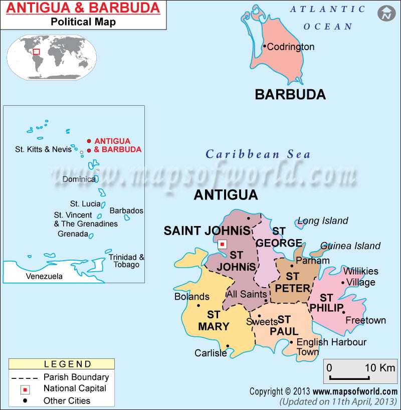
The Antigua Barbuda political map features important locations, cities, the national capital, and the Antigua Barbuda boundary of Antigua Barbuda Island. The map also has a separate section showing the neighboring islands and countries of Antigua Barbuda.
Some of the major cities of Antigua shown on the map include Cedar Grove, Parham, Willikies Village, Bolands, All Saints, Sweets, Freetown, Carlisle, and English Harbor Town.
Saint John’s, the national capital of the island is marked in a red square on the map.
A separate section on the Antigua Barbuda Political Map shows the neighboring countries and islands. These include St. Kitts and Nevis, Dominica, St. Lucia, St. Vincent and the Grenadines, Grenada, Barbados, Trinidad and Tobago, and Venezuela. All other neighboring islands and countries fall on the southern part of the island.
The pristine sandy beaches, bird sanctuaries, and resorts are top-rated tourist attractions in Antigua and Barbuda.
| Parish | Population | Area(km.²) | Area(mi.²) | Capital |
|---|---|---|---|---|
| Barbuda | 1,325 | 161 | 62 | Codrington |
| Redonda | 0 | 1 | 1 | |
| Saint George | 6,673 | 24 | 9 | Parham |
| Saint John | 45,346 | 74 | 29 | Saint John’s |
| Saint Mary | 6,793 | 59 | 23 | Bolands |
| Saint Paul | 7,848 | 48 | 19 | Nelson’s Dockyard |
| Saint Peter | 5,439 | 33 | 13 | Parham |
| Saint Philip | 3,462 | 44 | 17 | Carlisle |
| 8 divisions | 76,886 | 443 | 172 |

 Antigua and Barbuda Attractions