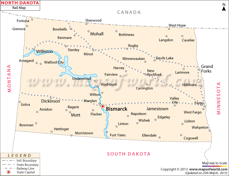
North Dakota Railway Map prominently marks the train routes of the state.
The North Dakota state map is also a vital indicator of the wide-reaching network of railways. Santa Fe, Soo Line and Burlington Northern are the prime railroads of the state of North Dakota in United States.
The railway map of North Dakota clearly highlights the various cities through which the trains of the state pass. Amtrak is a major railway service provider of North Dakota state. Amtrak-Empire Builder offers regularized train services to various locations of the state. The state of North Dakota possesses a total of 6366 km of track lines, as per one estimate of the year 2000. From the capital city – Bismarck – to other cities and towns the railways of North Dakota offers a developed connectivity to all locations of the state.
Cities like Fargo, Mandan, Minot, Williston, Dickinson, Devils Lake, New Rockford, Kenmare, Jamestown, Larimore, Bowbells, Stanley, Rugby and many others are efficiently connected by the railway tracks of state of North Dakota. Travelers going to various places of interest in North Dakota through trains can get a fair idea of this particular mode of transportation from the railway map of the state.
 Wall Maps