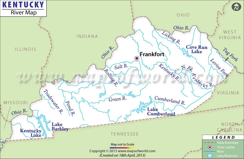
About Kentucky River Map
Kentucky River Maps shows the rivers, streams, and lakes of Kentucky.Main rivers in Kentucky are The Mississippi River in Kentucky, Kentucky River, Ohio River, Cumberland River, and Green River.
Kentucky falls under the watershed drainage area of the Mississippi river. The streams and rivers of the area drain into the Kentucky River, Licking River, Green River, Cumberland River, and the Ohio River. The Kentucky Maps point out the direction of flow of these rivers.
Kentucky has 2,982 miles of rivers that have transportation capabilities. The Kentucky River is one of the most important rivers of the state and runs a length of 259 miles. Most of the rivers of Kentucky, with the exception of the Cumberland River, flow in the northwest direction. The Tennessee-Tombigee Waterway joined the two rivers of Tombigee and Tennessee and helped to make the coalfields of Kentucky in the Appalachian area easily accessible to the Gulf of Mexico.
The Mississippi River, in Fulton county, is 256 feet long and is the lowest point of the state.
Kentucky has several man made lakes. The largest lake in Kentucky is Cumberland Lake. Lake Barkley, Kentucky Lake, and Dale Hollow Lake are some of the other prominent lakes of the state.
 Wall Maps