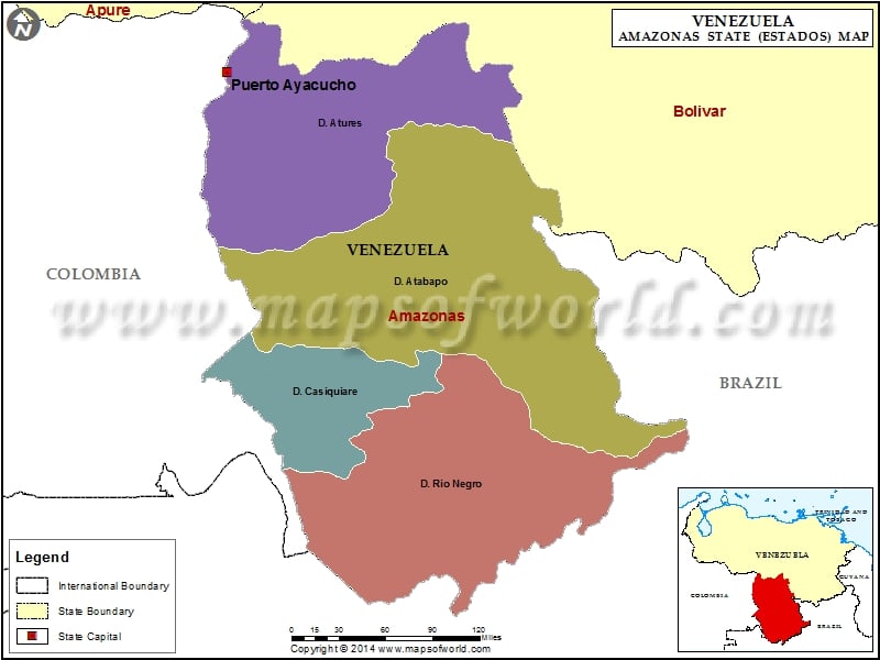
Amazonas is situated in Venezuela. Being one of the Venezuela states, Amazonas stretches over an area of 176,423 square kilometers. The Amazonas is the second largest state among the other states of Venezuela. The capital of Amazonas is Puerto Ayacucho. The name of this Venezuela state has been changed into Bolivarian Republic of Venezuela. The name was changed and named after Venezuelan national hero Simon Bolivar. States in Venezuela bear their independent flags. The Amazonas flag is designed keeping in view the natural landscape of the state.
This state of Venezuela is surrounded with Bolivar, Columbia and Brazil. While Bolivar lies to the north of Amazonas, Brazil surrounds the eastern and southern part of Amazonas. In the western part lies the state of Columbia. Like the other states of Venezuela, Amazonas has a tropical climate with no distinct winters.
The state is home to around 80,000 people of various ethnic groups. Piaroa, Guajibo and the Yanamani are the three ethnic groups. Amazonas is stationed between the basin of the Orinoco and the Negro rivers. The Negro river is a tributary of the Amazon river and the Orinoco river, which originates from the Brazilian border. The basins of the Orinoco and the Negro river are linked by the Casiquire channel draining into the Amazon basin.
Amazonas, despite being the second largest state, is sparsely populated.
Municipalities of Amazonas State (Estado) |
| Municipality | Capital | Population | Area(km.²) |
|---|---|---|---|
| Alto Orinoco | La Esmeralda | 657 | 49,217 |
| Atabapo | San Fernando de Atabapo | 3,121 | 25,062 |
| Atures | Puerto Ayacucho | 62,838 | 7,302 |
| Autana | Isla de Ratón | 754 | 12,291 |
| Manapiare | San Juan de Manapiare | 991 | 32,042 |
| Maroa | Maroa | 890 | 13,802 |
| Río Negro | San Carlos de Río Negro | 1,213 | 37,903 |
