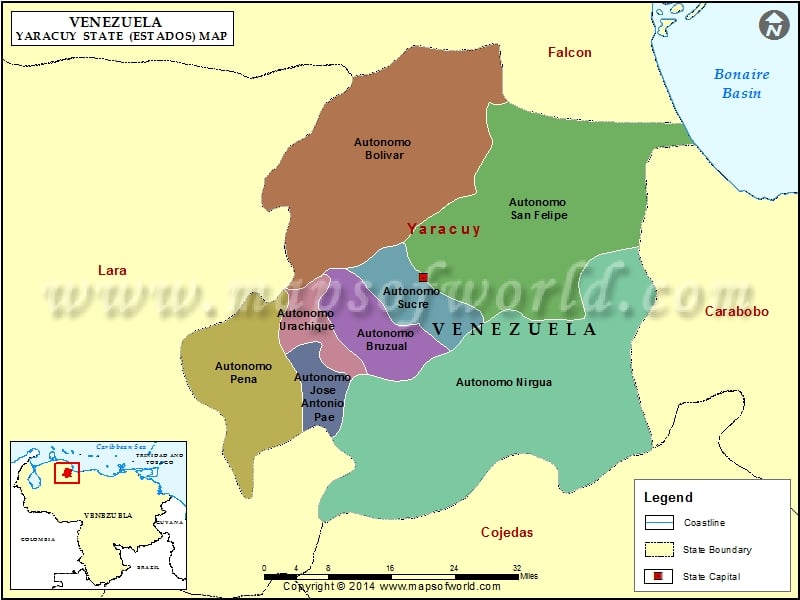
Yaracuy is the north western stare of Venezuela. This Venezuelan state is bound by Lara in the west, Cojedes in the south, Carabodo in the east and Falcon in the north. The Yaracuy river runs through this state to form a fertile valley. Yaracuy state in Venezuela stretches over an area of around 7,100 sq. km.
San Felipe the state capital was founded in 1729 and rebuilt in 1812 following a violent earthquake. The other important cities of this state are Aroa, Chivacoa, Nirgua, and Yaritagua. The population of Yaracuy state is almost 500,000.
Yaracuy climate and vegetation
Alike most of Venezuela, Yaracuy in Venezuela has a tropical climate characterized by dry and rainy seasons. The dry season extends from November to March/April, while the wet season lasts from April to October.
The vegetation of consists of cedars, apamates, jabillos, samanes, bucares and so on. The border area with Lara in the west consists of tunas, teasels and cujies.
Yaracuy economic activities
Agriculture is the main occupation of the inhabitants. Sweet potatoes, avocados are the main food crops grown in this state. The cash crops comprise peanuts, sugarcane, and palms. Alcoholic beverages, coffee and cardboard manufacturing are the main industries of this state. Yaracuy is rich in minerals. Copper, gold, aluminum, platinum, and lead are mined in this Venezuelan state.
Yaracuy attractions
The relief of Yaracuy is the greatest attraction of this state. The topography is varied with mountains, river valleys, and fertile plains. Western, Tiger, Pitiguao or Letreros, Paraguito, and Redoma are some of the famous mountains in this state. The Yaracuy and Aroa rivers form the river valleys and fertile plains that extend up to the Caribbean Sea coast.
Accommodation in Yaracuy is available in hotels and rented apartments in the important cities of this state. In rural areas a traveler can put up in lodges or village huts which are given out on rents.
Municipalities of Yaracuy State (Estado) |
| Municipality | Capital | Population | Area(km.²) |
|---|---|---|---|
| Arístides Bastidas | San Pablo | 16,839 | 74 |
| Bolívar | Aroa | 25,926 | 1,087 |
| Bruzual | Chivacoa | 59,059 | 417 |
| Cocorote | Cocorote | 35,668 | 135 |
| Independencia | Independencia | 46,191 | 98 |
| José Antonio Páez | Sabana de Parra | 15,101 | 135 |
| La Trinidad | Boraure | 13,258 | 62 |
| Manuel Monge | Yumare | 10,600 | 474 |
| Nirgua | Nirgua | 51,267 | 2,274 |
| Peña | Yaritagua | 81,518 | 510 |
| San Felipe | San Felipe | 86,169 | 472 |
| Sucre | Guama | 15,974 | 133 |
| Urachiche | Urachiche | 18,210 | 170 |
| Veroes | Farriar | 23,269 | 1,059 |
