- Costa Rica Provinces - Alajuela, Cartago, Guanacaste, Heredia, Limon, Puntarenas, San Jose
- Neighboring Countries - Nicaragua, Panama, El Salvador, Honduras, Guatemala
- Continent And Regions - North America Map, Americas Map
- Other Costa Rica Maps - Costa Rica Map, Costa Rica Blank Map, Costa Rica Road Map, Costa Rica Rail Map, Costa Rica River Map, Costa Rica Cities Map, Costa Rica Political Map, Costa Rica Physical Map, Costa Rica Flag
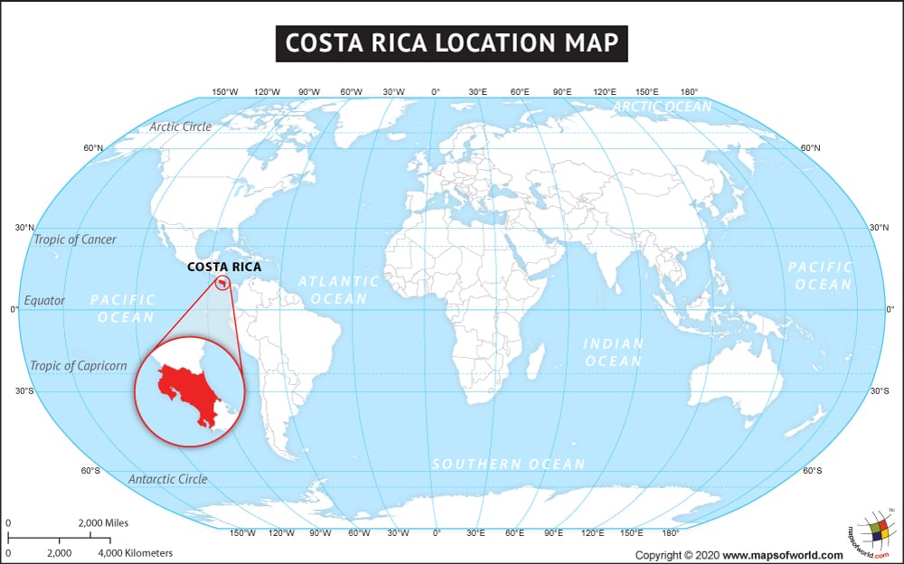
Costa Rica is a Central American country bounded by the North Pacific Ocean in the west and the Caribbean Sea in the east. Its land boundary is with Nicaragua in the north and Panama in the south and southeast. Costa Rica, officially the ‘Republic of Costa Rica’ has many islands within its territory, Calero Island is the largest island in the country. Costa Rica’s location between 8° and 12°N latitudes and 82° and 86°W longitudes is responsible for the country’s tropical and sub-tropical climate.
Costa Rica including all its territories covers a total area of 51,100 sq. km. and is the hundred and thirtieth largest country in the world. Costa Rica has a 1290 km long coastline. San Jose is its capital and the largest city and is also the sixth most important destination in Latin America.
Economically Costa Rica though is a developing country but as per UNDP, 2010 it has attained higher human development than many world countries at the same per capita income level. Culturally Costa Rica shows the essence of Spanish culture mainly because of the immigration of Spanish people in the early centuries. Costa Rica also has diverse plant and animal life. It has many protected areas and national parks, which attract many eco-tourists to the country.
Facts About Costa Rica |
|---|
| Country Name | Costa Rica |
|---|---|
| Continent | North America |
| Capital and largest city of Costa Rica | San Jose |
| Area | 51,100 km2 (19,653 sq mi) Water (%) 0.7 |
| Population | 5.2 million estimate |
| Lat Long of Costa Rica | 10.179433, -84.193760 |
| Official Language | Spanish |
| Calling Code | +506 |
| Time Zone | CST (UTC−6) |
| Airports in Costa Rica | 29 Airports in Costa Rica |
| Neighbor countries | Nicaragua, Panama |
| Internet TLD | .cr |
| Currency | Costa Rican colon (CRC) |
