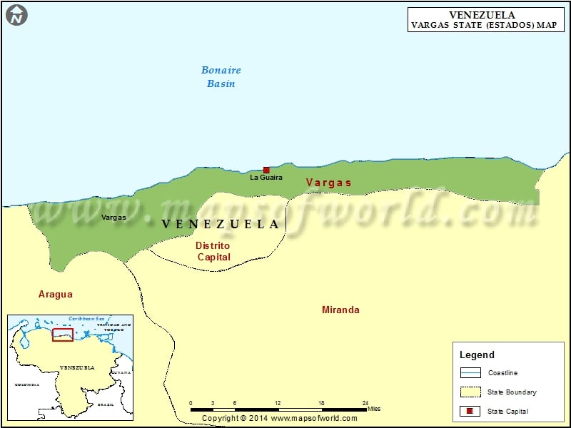
Vargas is a new Venezuelan state created in 1997. This Venezuelan state borders the Caribbean Sea with a coastline of 160 km. Vargas state in Venezuela having a population of about 333,000 is spread over an area of approximately 1,500 sq. km. The state of Vargas has its capital in La Guaira.
La Guaira is the commercial and political center of Vargas state. The governor is the executive head of the state. A legislative council forms the legislature of Vargas state in Venezuela.
Vargas Climate
The climate of Vargas in Venezuela is tropical in nature, with average temperature varying between 25ºC and 27º C. The annual rainfall ranges between 90cm – 150cm.
Vargas tourist attractions
The Vargas coastline has many beaches that are important tourist attractions. Catia La Mar, El Palmar, Playa Grande, Macuto, Anare are some of the famous beaches on Vargas coast. San Carlos fort, Bolivar Street, Guipuzcoana house, the gangways of Gaumaucho and Muchinga are the famous monuments to be seen in La Guaira the capital of Vargas.
Accommodation
Accommodation in La Guaira is available in budget and luxury hotels. Accommodation in the smaller towns and villages are available in lodges or local houses.
Vargas with its hilly terrain and a coastline with sandy beaches is an important tourist destination in Venezuela.
Municipalities of Vargas State (Estado) |
| Municipality | Capital | Population | Area(km.²) |
|---|---|---|---|
| Vargas | La Guaira | 298,109 | 1,497 |

 Maracaibo