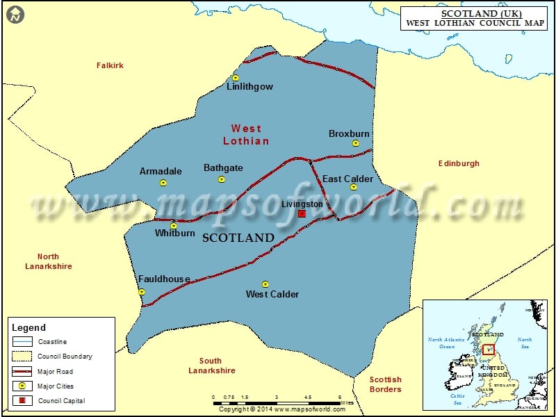
A historic county and one of the 32 council regions of Scotland, the West Lothian Council is spread over a total area of 165 square miles. It has a population of 185,000 as per the 2022 estimates.
The West Lothian council region was formed in 1996 through the Local Government etc. (Scotland) Act 1994 with the incorporation of the West Lothian district that belonged to the Lothian area. The administrative headquarters of the council is located at Livingston.
The council area is bordered by Falkirk, the Scottish Borders, the city of Edinburgh, North Lanarkshire, and South Lanarkshire. Some of the towns and villages of the area comprise Whitburn, Livingston, Blackburn, Uphall, Westfield, Philpstoun, Greenrigg, East and West Calder, etc.
There are 33 elected members or councilors in the West Lothian Council and they represent the nine multi-member wards. The council possesses three Depute Chief Executives and a Chief Executive and they are entrusted to take care of such services as education, area, and planning services, community health and care partnership, corporate, housing, and operational services, etc. There are also two Scottish Parliamentary constituencies out of the four Scottish Youth Parliamentary Seats.
Councillor Cathy Muldoon is the Provost of the West Lothian. Lawrence Fitzpatrick is the leader of the West Lothian Council.
Cities in West Lothian Council |
|||
| Council | City | Latitude | Longitude |
|---|---|---|---|
| West Lothian | Fauldhouse | 55.82 | -3.72 |
| West Lothian | West Calder | 55.83 | -3.57 |
| West Lothian | Whitburn | 55.866794 | -3.685019 |
| West Lothian | Armadale | 55.89568 | -3.70064 |
| West Lothian | Bathgate | 55.9 | -3.63 |
| West Lothian | East Calder | 55.9 | -3.47 |
| West Lothian | Broxburn | 55.93 | -3.47 |
| West Lothian | Linlithgow | 55.97 | -3.62 |
