- Neighboring Countries - Slovenia, Bosnia, Serbia, Hungary, Italy
- Continent And Regions - Europe Map
- Other Croatia Maps - Croatia Map, Croatia Blank Map, Croatia Road Map, Croatia Rail Map, Croatia River Map, Croatia Political Map, Croatia Physical Map, Croatia Flag
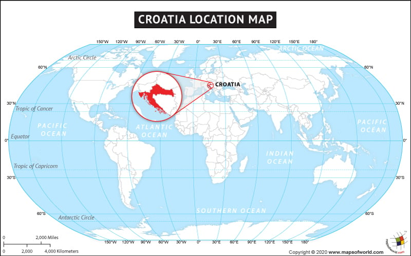
The Republic of Croatia is a Mediterranean country in Southeastern Europe. It is bordered by Slovenia in the northwest, Hungary in the northeast, Bosnia and Herzegovina and Montenegro in the southeast, and Serbia in the east. Its coastal boundary with the Adriatic Sea is in the southwest. In fact, it has the longest coastline in southeastern Europe on the Adriatic Sea. The total area of the country is 56,594 sq. km, with 620 sq. km of water area, it is the 127th largest country in the world. The country is spread across 45° 10′ N latitude and 15° 30′ E longitude. The capital city Zagreb is also the largest city in the country.
One of the 18th most popular tourist destinations in the world, summer in Croatia attracts thousands of visitors to the country. Croatia enjoys the Mediterranean and continental climates, it is also one of the rich bio-diverse countries in Europe. Croatia’s rich natural and cultural heritage makes it a country with ten listed UNESCO Intangible Cultural Masterpieces and seven UNESCO World Heritage sites on its land. Croatia is well connected and can be reached easily from other parts of Europe and the world.
Facts About Croatia |
| Country Name | Croatia |
|---|---|
| Continent | Europe |
| Capital and largest city of Croatia | Zagreb |
| Area | 56,594 km2 (21,851 sq mi ) Water (%) 1.09 |
| Population of Croatia | 4.05 million estimate |
| Lat Long of Croatia | 45.10° N and 15.30° E |
| Official Language | Croatian |
| Calling Code | +385 |
| Time Zone | CET (UTC+1) Summer (DST) CEST (UTC+2) |
| Airports in Croatia | 9 Airports, scheduled service – 8 |
| Neighbor countries | Slovenia, Bosnia and Herzegovina, Serbia, Montenegro, Hungary |
| Internet TLD | .hr |
| Currency | Croatian kuna (HRK) |
